Earthquake 9 km WNW of The Geysers, CA
Tue, 17 Feb 2026 23:36:52 GMT
Time12 hours ago
Location
38.8222, -122.8450
Depth
1.8 KM
Event Summary
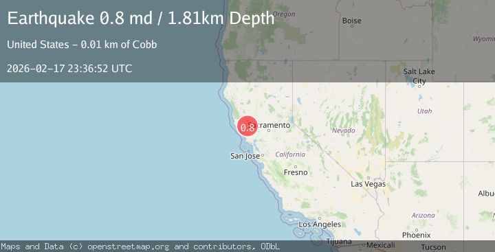
A 0.8 magnitude earthquake struck on 9 km WNW of The Geysers, CA, at Tue, 17 Feb 2026 23:36:52 GMT. Depth: 1.80999994277954km. Reviewed by USGS seismologists, this minor quake occurred at a magnitude type of md.
Magnitude
0.8
md
Source
USGS
Intensity
-
Agency Reports
1 Sources| Source | Magnitude | Depth | Time |
|---|---|---|---|
| USGSPrimary | 0.8 | 2 km | 12 hours ago |
Earthquake Details
AutomaticEvent IDusgs_nc75315377
Tsunami PotentialNo
Magnitude Typemd
Nearest Places
- Buckeye Mine1.1 km
- Truitt Creek1.4 km
- Black Oaks1.4 km
- Adit Number One-One Hundred Twenty1.8 km
- Eagle Rock1.9 km
Comments
Join the discussion about this event.
Latest Earthquakes
1.8Mag
Poland
Time12 hours ago
Depth4.27 km
SourceVYT (Automatic)
1.6Mag
58 km WNW of Toyah, Texas
Time12 hours ago
Depth0.00 km
SourceUSGS (Automatic)
2.7Mag
Java, Indonesia
Time12 hours ago
Depth25.84 km
SourceBMKG
1.8Mag
CENTRAL TURKEY
Time12 hours ago
Depth7.10 km
SourceAFAD (Automatic)
2.6Mag
Sumbawa region, Indonesia
Time12 hours ago
Depth155.40 km
SourceVYT (Automatic)
Nearby Earthquakes
0.8Mag
9 km WNW of The Geysers, CA
Time3 weeks ago
Depth1.50 km
SourceUSGS (Automatic)
1.5Mag
9 km WNW of The Geysers, CA
Time3 weeks ago
Depth2.24 km
SourceUSGS (Automatic)
0.6Mag
9 km WNW of The Geysers, CA
Time1 day ago
Depth2.13 km
SourceUSGS (Automatic)
0.7Mag
9 km WNW of The Geysers, CA
Time3 weeks ago
Depth2.32 km
SourceUSGS (Automatic)
0.8Mag
9 km WNW of The Geysers, CA
Time4 days ago
Depth1.94 km
SourceUSGS (Automatic)