Earthquake 4 km ESE of San Ramon, CA
Mon, 16 Feb 2026 01:32:29 GMT
Time4 days ago
Location
37.7600, -121.9393
Depth
7.8 KM
Event Summary
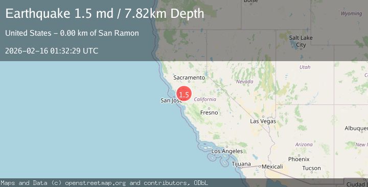
A 1.5 magnitude earthquake struck on 4 km ESE of San Ramon, CA, at Mon, 16 Feb 2026 01:32:29 GMT. Depth: 7.82000017166138km. Reviewed by USGS seismologists, this minor quake occurred at a magnitude type of md.
Magnitude
1.5
md
Source
USGS
Intensity
-
Agency Reports
1 Sources| Source | Magnitude | Depth | Time |
|---|---|---|---|
| USGSPrimary | 1.5 | 8 km | 4 days ago |
Earthquake Details
AutomaticEvent IDusgs_nc75314432
Tsunami PotentialNo
Magnitude Typemd
Nearest Places
- City of San Ramon0.4 km
- Canyon Lakes Golf Course0.5 km
- San Ramon Village Shopping Center0.7 km
- Coyote Creek0.8 km
- Oakwood San Ramon0.8 km
Comments
Join the discussion about this event.
Latest Earthquakes
3.2Mag
Tarapaca, Chile
Time5 minutes ago
Depth111.21 km
SourceVYT (Automatic)
2.0Mag
CENTRAL TURKEY
Time11 minutes ago
Depth3.40 km
SourceKOERI (Automatic)
2.7Mag
Central Alaska
Time13 minutes ago
Depth82.89 km
SourceVYT (Automatic)
1.5Mag
western Texas
Time13 minutes ago
Depth0.49 km
SourceVYT (Automatic)
1.7Mag
STRAIT OF GIBRALTAR
Time17 minutes ago
Depth1.50 km
SourceIGN (Automatic)
Nearby Earthquakes
2.3Mag
SAN FRANCISCO BAY AREA, CALIF.
Time2 weeks ago
Depth8.20 km
SourceNC (Automatic)
1.7Mag
4 km SE of San Ramon, CA
Time2 hours ago
Depth7.10 km
SourceUSGS (Automatic)
1.9Mag
4 km SE of San Ramon, CA
Time2 weeks ago
Depth8.44 km
SourceUSGS (Automatic)
2.5Mag
SAN FRANCISCO BAY AREA, CALIF.
Time2 weeks ago
Depth7.20 km
SourceNC (Automatic)
1.6Mag
4 km ESE of San Ramon, CA
Time1 week ago
Depth3.21 km
SourceUSGS (Automatic)