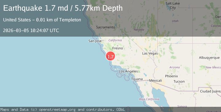
Earthquake 8 km W of Templeton, CA
Thu, 05 Mar 2026 10:24:07 GMT
Time2 hours ago
Location
35.5515, -120.7922
Depth
5.8 KM
Event Summary
A 1.7 magnitude earthquake struck on 8 km W of Templeton, CA, at Thu, 05 Mar 2026 10:24:07 GMT. Depth: 5.76999998092651km. Reviewed by USGS seismologists, this minor quake occurred at a magnitude type of md.
Magnitude
1.7
md
Source
USGS
Intensity
-
Agency Reports
1 Sources| Source | Magnitude | Depth | Time |
|---|---|---|---|
| USGSPrimary | 1.7 | 6 km | 2 hours ago |
Earthquake Details
AutomaticEvent IDusgs_nc75322952
Tsunami PotentialNo
Magnitude Typemd
Nearest Places
- 0.3 km
- 1.5 km
- 1.6 km
- 1.6 km
- 1.8 km
Comments
Join the discussion about this event.
Latest Earthquakes
2.5Mag
Sumbawa Region, Indonesia
Time2 hours ago
Depth113.14 km
SourceBMKG
2.7Mag
Tarapaca, Chile
Time2 hours ago
Depth132.81 km
SourceVYT (Automatic)
2.8Mag
Southeastern Alaska
Time2 hours ago
Depth0.00 km
SourceVYT (Automatic)
2.7Mag
Timor region, Indonesia
Time2 hours ago
Depth27.34 km
SourceVYT (Automatic)
1.6Mag
Southern Alaska
Time2 hours ago
Depth0.00 km
SourceVYT (Automatic)
Nearby Earthquakes
2.7Mag
CENTRAL CALIFORNIA
Time2 months ago
Depth5.00 km
SourceNEIC (Automatic)
1.9Mag
7 km W of Templeton, CA
Time6 days ago
Depth5.86 km
SourceUSGS (Automatic)
2.0Mag
CENTRAL CALIFORNIA
Time1 day ago
Depth6.20 km
SourceNC (Automatic)
3.0Mag
CENTRAL CALIFORNIA
Time6 years ago
Depth5.00 km
SourceNC (Automatic)
1.5Mag
11 km W of Templeton, CA
Time6 days ago
Depth4.96 km
SourceUSGS (Automatic)