Earthquake 76 km NE of Tonopah, Nevada
Mon, 02 Mar 2026 09:36:45 GMT
Time1 hour ago
Location
38.4560, -116.5032
Depth
8.5 KM
Event Summary
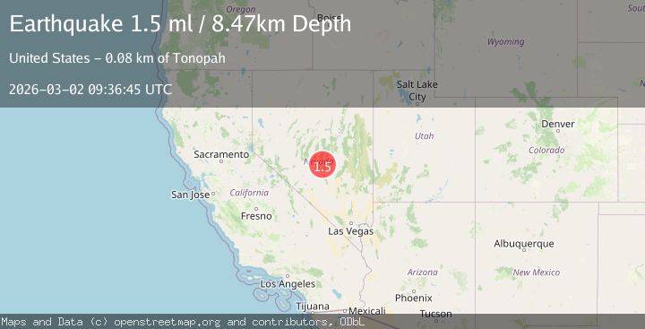
A 1.5 magnitude earthquake struck on 76 km NE of Tonopah, Nevada, at Mon, 02 Mar 2026 09:36:45 GMT. Depth: 8.4733km. Reviewed by USGS seismologists, this minor quake occurred at a magnitude type of ml.
Magnitude
1.5
ml
Source
USGS
Intensity
-
Agency Reports
1 Sources| Source | Magnitude | Depth | Time |
|---|---|---|---|
| USGSPrimary | 1.5 | 8 km | 1 hour ago |
Earthquake Details
AutomaticEvent IDusgs_nn00911620
Tsunami PotentialNo
Magnitude Typeml
Nearest Places
- 1.3 km
- 4.6 km
- 4.9 km
- 5.5 km
- 6.7 km
Comments
Join the discussion about this event.
Latest Earthquakes
1.4Mag
Tarapaca, Chile
Time1 hour ago
Depth0.00 km
SourceVYT (Automatic)
2.3Mag
Borneo
Time1 hour ago
Depth70.92 km
SourceBMKG
2.9Mag
Minahassa Peninsula, Sulawesi
Time1 hour ago
Depth1.53 km
SourceBMKG
1.3Mag
2 km NW of Ocotillo, CA
Time1 hour ago
Depth11.39 km
SourceUSGS (Automatic)
3.1Mag
northern Colombia
Time1 hour ago
Depth222.41 km
SourceVYT (Automatic)
Nearby Earthquakes
1.6Mag
77 km NE of Tonopah, Nevada
Time10 hours ago
Depth15.79 km
SourceUSGS (Automatic)
3.0Mag
NEVADA
Time4 months ago
Depth5.00 km
SourceNEIC (Automatic)
3.1Mag
NEVADA
Time13 hours ago
Depth5.00 km
SourceNN (Automatic)
2.4Mag
76 km NE of Tonopah, Nevada
Time13 hours ago
Depth4.05 km
SourceUSGS (Automatic)
1.6Mag
75 km NE of Tonopah, Nevada
Time15 hours ago
Depth16.00 km
SourceUSGS (Automatic)