Earthquake 80 km NE of Tonopah, Nevada
Mon, 02 Mar 2026 10:57:19 GMT
Time1 hour ago
Location
38.4800, -116.4690
Depth
4.8 KM
Event Summary
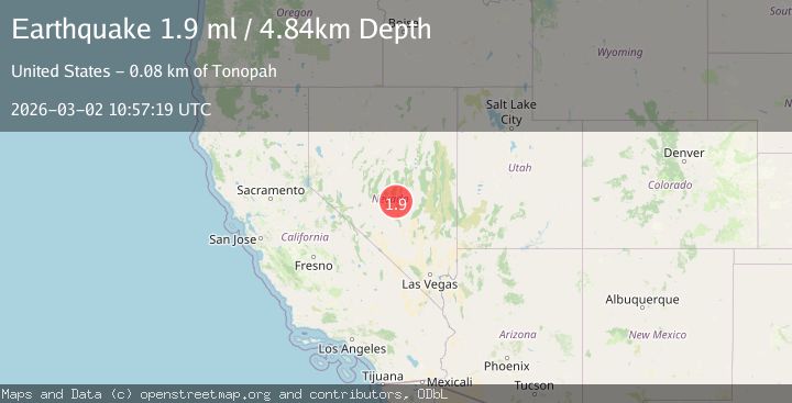
A 1.9 magnitude earthquake struck on 80 km NE of Tonopah, Nevada, at Mon, 02 Mar 2026 10:57:19 GMT. Depth: 4.8446km. Reviewed by USGS seismologists, this minor quake occurred at a magnitude type of ml.
Magnitude
1.9
ml
Source
USGS
Intensity
-
Agency Reports
1 Sources| Source | Magnitude | Depth | Time |
|---|---|---|---|
| USGSPrimary | 1.9 | 5 km | 1 hour ago |
Earthquake Details
AutomaticEvent IDusgs_nn00911627
Tsunami PotentialNo
Magnitude Typeml
Nearest Places
- 3.8 km
- 5.3 km
- 5.7 km
- 5.8 km
- 5.9 km
Comments
Join the discussion about this event.
Latest Earthquakes
1.8Mag
Central Alaska
Time1 hour ago
Depth11.96 km
SourceVYT (Automatic)
3.2Mag
Bio-Bio, Chile
Time1 hour ago
Depth10.00 km
SourceVYT (Automatic)
2.2Mag
OKLAHOMA
Time1 hour ago
Depth10.00 km
SourceOK (Automatic)
2.6Mag
offshore Valparaiso, Chile
Time1 hour ago
Depth19.17 km
SourceVYT (Automatic)
2.2Mag
FRANCE
Time1 hour ago
Depth13.70 km
SourceETHZ (Automatic)
Nearby Earthquakes
3.5Mag
NEVADA
Time17 hours ago
Depth5.60 km
SourceNN (Automatic)
2.2Mag
80 km NE of Tonopah, Nevada
Time1 day ago
Depth4.77 km
SourceUSGS (Automatic)
1.6Mag
80 km NE of Tonopah, Nevada
Time1 day ago
Depth1.64 km
SourceUSGS (Automatic)
1.8Mag
81 km NE of Tonopah, Nevada
Time6 hours ago
Depth11.57 km
SourceUSGS (Automatic)
1.7Mag
79 km NE of Tonopah, Nevada
Time17 hours ago
Depth0.04 km
SourceUSGS (Automatic)