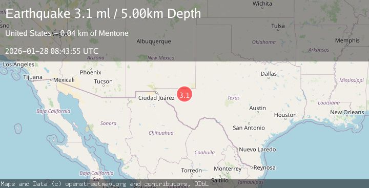
Earthquake 39 km NNW of Toyah, Texas
Wed, 28 Jan 2026 08:47:37 GMT
Time1 hour ago
Location
31.6210, -104.0050
Depth
6.7 KM
Event Summary
A 3.1 magnitude earthquake struck on 39 km NNW of Toyah, Texas, at Wed, 28 Jan 2026 08:47:37 GMT. Depth: 6.7172km. Reviewed by USGS seismologists, this minor quake occurred at a magnitude type of ml.
Magnitude
3.1
ml
Source
USGS
Intensity
-
Agency Reports
2 Sources| Source | Magnitude | Depth | Time |
|---|---|---|---|
| USGSPrimary | 3.1 | 5 km | 1 hour ago |
| NEIC | 3.1 | 5 km | 1 hour ago |
Earthquake Details
AutomaticEvent IDusgs_tx2026bygbuz
Tsunami PotentialNo
Magnitude Typeml
Nearest Places
- Cottonwood Tank3.0 km
- Rabbit Tank3.3 km
- Derrick Ranch4.6 km
- Derrick Draw4.9 km
- Threemile Tank5.6 km
Comments
Join the discussion about this event.
Latest Earthquakes
2.2Mag
West Papua Region, Indonesia
Time3 minutes ago
Depth7.51 km
SourceBMKG (Automatic)
1.5Mag
4 km WNW of The Geysers, CA
Time5 minutes ago
Depth1.56 km
SourceUSGS (Automatic)
2.6Mag
Flores Sea
Time10 minutes ago
Depth141.92 km
SourceBMKG (Automatic)
1.5Mag
8 km NNW of Delano, CA
Time22 minutes ago
Depth18.79 km
SourceUSGS (Automatic)
3.1Mag
MORO GULF, MINDANAO, PHILIPPINES
Time23 minutes ago
Depth4.00 km
SourcePIVS (Automatic)
Nearby Earthquakes
2.1Mag
36 km NNW of Toyah, Texas
Time1 day ago
Depth4.41 km
SourceUSGS (Automatic)
1.5Mag
37 km NW of Toyah, Texas
Time5 days ago
Depth6.63 km
SourceUSGS (Automatic)
2.0Mag
WESTERN TEXAS
Time1 week ago
Depth4.30 km
SourceTX (Automatic)
1.5Mag
36 km NW of Toyah, Texas
Time2 days ago
Depth5.77 km
SourceUSGS (Automatic)
1.7Mag
34 km NW of Toyah, Texas
Time2 days ago
Depth4.59 km
SourceUSGS (Automatic)