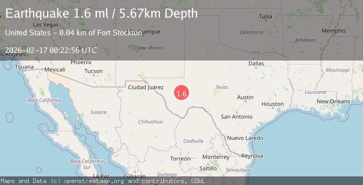
Earthquake 41 km W of Fort Stockton, Texas
Tue, 17 Feb 2026 00:22:56 GMT
Time1 day ago
Location
30.9240, -103.3110
Depth
5.7 KM
Event Summary
A 1.6 magnitude earthquake struck on 41 km W of Fort Stockton, Texas, at Tue, 17 Feb 2026 00:22:56 GMT. Depth: 5.6731km. Reviewed by USGS seismologists, this minor quake occurred at a magnitude type of ml.
Magnitude
1.6
ml
Source
USGS
Intensity
-
Agency Reports
1 Sources| Source | Magnitude | Depth | Time |
|---|---|---|---|
| USGSPrimary | 1.6 | 6 km | 1 day ago |
Earthquake Details
AutomaticEvent IDusgs_tx2026dihxbp
Tsunami PotentialNo
Magnitude Typeml
Nearest Places
- Riggs Windmill1.8 km
- Section Three Windmill2.1 km
- Schoolhouse Draw2.7 km
- Tucker Hill3.6 km
- Red Windmill4.4 km
Comments
Join the discussion about this event.
Latest Earthquakes
2.5Mag
Java, Indonesia
Time3 minutes ago
Depth76.49 km
SourceBMKG
1.9Mag
Tarapaca, Chile
Time9 minutes ago
Depth7.93 km
SourceVYT (Automatic)
2.4Mag
West Papua Region, Indonesia
Time9 minutes ago
Depth10.00 km
SourceBMKG
2.7Mag
Antofagasta, Chile
Time11 minutes ago
Depth0.00 km
SourceVYT (Automatic)
2.7Mag
Tarapaca, Chile
Time16 minutes ago
Depth10.50 km
SourceVYT (Automatic)
Nearby Earthquakes
3.0Mag
WESTERN TEXAS
Time4 years ago
Depth5.00 km
SourceNEIC (Automatic)
1.7Mag
37 km E of Balmorhea, Texas
Time2 weeks ago
Depth5.65 km
SourceUSGS (Automatic)
2.3Mag
30 km W of Fort Stockton, Texas
Time1 day ago
Depth9.45 km
SourceUSGS (Automatic)
1.6Mag
34 km SW of Coyanosa, Texas
Time3 weeks ago
Depth6.45 km
SourceUSGS (Automatic)
3.0Mag
WESTERN TEXAS
Time4 years ago
Depth5.00 km
SourceNEIC (Automatic)