Earthquake 49 km SSE of Mbumi, Tanzania
Tue, 20 Jan 2026 17:11:38 GMT
Time1 week ago
Location
-8.3278, 39.3491
Depth
10.0 KM
Event Summary
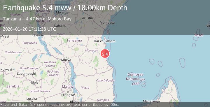
A 5.4 magnitude earthquake struck on 49 km SSE of Mbumi, Tanzania, at Tue, 20 Jan 2026 17:11:38 GMT. Depth: 10km. Reviewed by USGS seismologists, this moderate quake occurred at a magnitude type of mww.
Magnitude
5.4
mww
Source
USGS
Intensity
-
Agency Reports
1 Sources| Source | Magnitude | Depth | Time |
|---|---|---|---|
| USGSPrimary | 5.4 | 10 km | 1 week ago |
Earthquake Details
ConfirmedEvent IDusgs_us7000rqva
Tsunami PotentialNo
Magnitude Typemww
Nearest Places
- Mohoro Bay4.5 km
- Okambara4.9 km
- Miza5.7 km
- Ras Pombwe6.1 km
- Afisi6.2 km
Comments
Join the discussion about this event.
Latest Earthquakes
3.3Mag
SOUTHERN ALASKA
Time3 hours ago
Depth98.60 km
SourceAK (Automatic)
2.0Mag
18 km E of Ferry, Alaska
Time3 hours ago
Depth5.00 km
SourceUSGS (Automatic)
2.5Mag
Flores Region, Indonesia
Time3 hours ago
Depth170.05 km
SourceBMKG (Automatic)
1.7Mag
44 km NW of Tatitlek, Alaska
Time3 hours ago
Depth5.00 km
SourceUSGS (Automatic)
2.1Mag
Sumbawa Region, Indonesia
Time3 hours ago
Depth10.00 km
SourceBMKG (Automatic)