Earthquake 17 km E of Ferry, Alaska
Tue, 03 Feb 2026 00:21:01 GMT
Time2 hours ago
Location
64.0190, -148.7540
Depth
5.0 KM
Event Summary
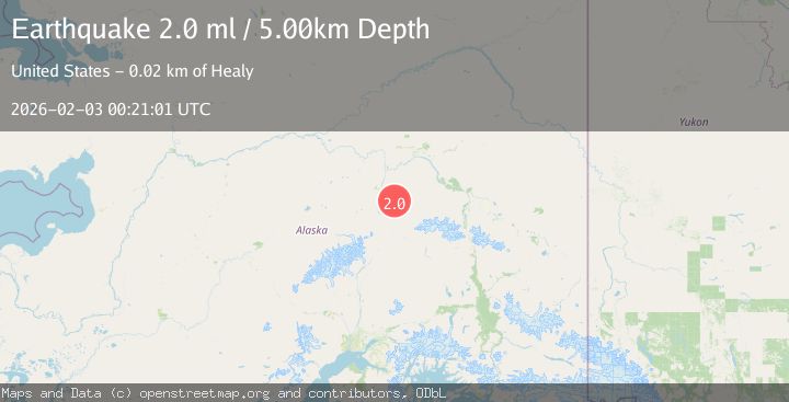
A 1.5 magnitude earthquake struck on 17 km E of Ferry, Alaska, at Tue, 03 Feb 2026 00:21:01 GMT. Depth: 5km. Reviewed by USGS seismologists, this minor quake occurred at a magnitude type of ml.
Magnitude
1.5
ml
Source
USGS
Intensity
-
Agency Reports
1 Sources| Source | Magnitude | Depth | Time |
|---|---|---|---|
| USGSPrimary | 1.5 | 5 km | 2 hours ago |
Earthquake Details
AutomaticEvent IDusgs_ak2026cipred
Tsunami PotentialNo
Magnitude Typeml
Nearest Places
- North Fork Emma Creek1.1 km
- Emma Creek1.6 km
- Bonanza Creek2.4 km
- Marguerite Creek2.4 km
- McAdam Creek3.2 km
Comments
Join the discussion about this event.
Latest Earthquakes
2.5Mag
Flores Region, Indonesia
Time2 hours ago
Depth170.05 km
SourceBMKG (Automatic)
1.7Mag
44 km NW of Tatitlek, Alaska
Time2 hours ago
Depth5.00 km
SourceUSGS (Automatic)
2.1Mag
Sumbawa Region, Indonesia
Time2 hours ago
Depth10.00 km
SourceBMKG (Automatic)
1.8Mag
4 km SE of San Ramon, CA
Time2 hours ago
Depth6.96 km
SourceUSGS (Automatic)
3.3Mag
Java, Indonesia
Time2 hours ago
Depth90.20 km
SourceBMKG (Automatic)
Nearby Earthquakes
2.8Mag
19 km ENE of Ferry, Alaska
Time6 days ago
Depth5.00 km
SourceUSGS (Automatic)
2.6Mag
17 km ENE of Ferry, Alaska
Time1 week ago
Depth5.00 km
SourceUSGS
2.2Mag
13 km NW of Ferry, Alaska
Time1 week ago
Depth139.50 km
SourceUSGS (Automatic)
1.7Mag
25 km W of Denali Park, Alaska
Time1 day ago
Depth112.20 km
SourceUSGS (Automatic)
1.3Mag
12 km SSE of Nenana, Alaska
Time1 week ago
Depth1.80 km
SourceUSGS (Automatic)