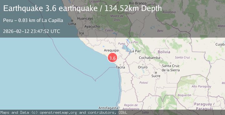
Earthquake near the coast of southern Peru
Thu, 12 Feb 2026 23:47:52 GMT
Time5 days ago
Location
-17.0190, -71.3612
Depth
134.5 KM
Event Summary
A 3.6 magnitude earthquake struck on near the coast of southern Peru, at Thu, 12 Feb 2026 23:47:52 GMT. Depth: 134.521484375km. Reviewed by VYT seismologists, this minor quake occurred at a magnitude type of earthquake.
Magnitude
3.6
earthquake
Source
VYT
Intensity
-
Agency Reports
1 Sources| Source | Magnitude | Depth | Time |
|---|---|---|---|
| VYTPrimary | 3.6 | 135 km | 5 days ago |
Earthquake Details
AutomaticEvent IDvyt_1e5njghjqvz56
Tsunami PotentialNo
Magnitude Typeearthquake
Nearest Places
- Cerro San Francisco0.7 km
- Cerro Portillo3.5 km
- Cerro Ocsobaya3.7 km
- Quebrada Tunaquea5.2 km
- Machado Grande5.4 km
Comments
Join the discussion about this event.
Latest Earthquakes
1.0Mag
Southeastern Alaska
Time2 minutes ago
Depth0.00 km
SourceVYT (Automatic)
3.5Mag
COOK STRAIT, NEW ZEALAND
Time3 minutes ago
Depth75.30 km
SourceGNS (Automatic)
2.4Mag
Seram, Indonesia
Time5 minutes ago
Depth18.42 km
SourceBMKG
2.6Mag
West Papua Region, Indonesia
Time8 minutes ago
Depth17.35 km
SourceBMKG
2.8Mag
Antofagasta, Chile
Time11 minutes ago
Depth0.00 km
SourceVYT (Automatic)
Nearby Earthquakes
5.2Mag
SOUTHERN PERU
Time20 years ago
Depth80.00 km
SourceEMSC (Automatic)
3.7Mag
NEAR COAST OF SOUTHERN PERU
Time2 days ago
Depth76.00 km
SourceLIM (Automatic)
4.2Mag
NEAR COAST OF SOUTHERN PERU
Time1 month ago
Depth74.00 km
SourceLIM (Automatic)
5.0Mag
SOUTHERN PERU
Time3 years ago
Depth20.00 km
SourceEMSC (Automatic)
4.0Mag
NEAR COAST OF SOUTHERN PERU
Time2 years ago
Depth115.00 km
SourceLIM (Automatic)