Earthquake Southeastern Alaska
Fri, 13 Feb 2026 01:38:22 GMT
Time5 days ago
Location
60.4513, -140.1322
Depth
13.8 KM
Event Summary
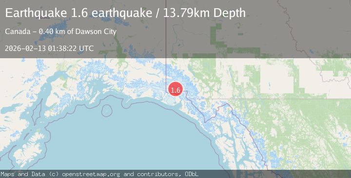
A 1.6 magnitude earthquake struck on Southeastern Alaska, at Fri, 13 Feb 2026 01:38:22 GMT. Depth: 13.7939453125km. Reviewed by VYT seismologists, this minor quake occurred at a magnitude type of earthquake.
Magnitude
1.6
earthquake
Source
VYT
Intensity
-
Agency Reports
1 Sources| Source | Magnitude | Depth | Time |
|---|---|---|---|
| VYTPrimary | 1.6 | 14 km | 5 days ago |
Earthquake Details
AutomaticEvent IDvyt_249ov0tfmt8av
Tsunami PotentialNo
Magnitude Typeearthquake
Nearest Places
- Marker Lake10.4 km
- McArthur Peak17.8 km
- Corwin Cliffs19.5 km
- Mount Logan19.7 km
- Mount King George20.9 km
Comments
Join the discussion about this event.
Latest Earthquakes
1.3Mag
3 km W of Cobb, CA
Time5 hours ago
Depth1.89 km
SourceUSGS (Automatic)
2.8Mag
West Papua Region, Indonesia
Time5 hours ago
Depth10.00 km
SourceBMKG
2.8Mag
Java, Indonesia
Time5 hours ago
Depth12.47 km
SourceBMKG
2.6Mag
HALMAHERA, INDONESIA
Time5 hours ago
Depth16.00 km
SourceBMKG (Automatic)
2.9Mag
Southern Molucca Sea
Time5 hours ago
Depth170.58 km
SourceBMKG
Nearby Earthquakes
2.7Mag
SOUTHERN YUKON TERRITORY, CANADA
Time1 month ago
Depth5.00 km
SourceNEIC (Automatic)
2.7Mag
SOUTHERN YUKON TERRITORY, CANADA
Time1 month ago
Depth10.00 km
SourceNEIC (Automatic)
2.7Mag
SOUTHERN YUKON TERRITORY, CANADA
Time2 months ago
Depth5.00 km
SourceNEIC (Automatic)
2.5Mag
Southeastern Alaska
Time4 days ago
Depth0.00 km
SourceVYT (Automatic)
2.7Mag
SOUTHERN YUKON TERRITORY, CANADA
Time1 month ago
Depth5.00 km
SourceNEIC (Automatic)