Earthquake Southern Alaska
Mon, 16 Feb 2026 02:02:31 GMT
Time2 days ago
Location
61.1644, -152.1477
Depth
24.4 KM
Event Summary
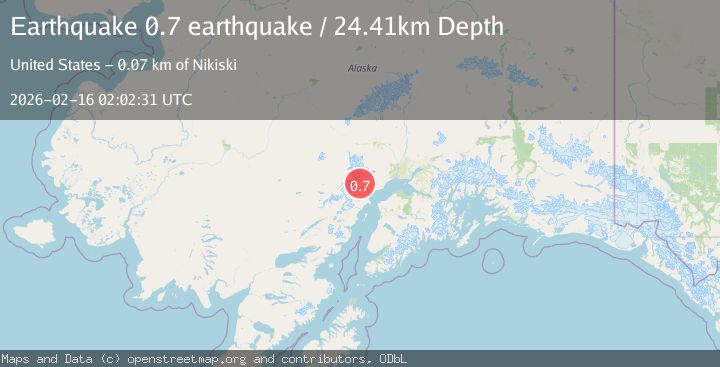
A 0.7 magnitude earthquake struck on Southern Alaska, at Mon, 16 Feb 2026 02:02:31 GMT. Depth: 24.4140625km. Reviewed by VYT seismologists, this minor quake occurred at a magnitude type of earthquake.
Magnitude
0.7
earthquake
Source
VYT
Intensity
-
Agency Reports
1 Sources| Source | Magnitude | Depth | Time |
|---|---|---|---|
| VYTPrimary | 0.7 | 24 km | 2 days ago |
Earthquake Details
AutomaticEvent IDvyt_25z63v0e4gswa
Tsunami PotentialNo
Magnitude Typeearthquake
Nearest Places
- K’idazq’eni Glacier7.2 km
- Neacola Mountains7.9 km
- Aleutian Range10.0 km
- Crater Glacier11.0 km
- Ch'atanalch'elt Li'a12.5 km
Comments
Join the discussion about this event.
Latest Earthquakes
2.4Mag
Northern Sumatra, Indonesia
Time19 hours ago
Depth7.72 km
SourceBMKG
2.3Mag
Tarapaca, Chile
Time19 hours ago
Depth61.65 km
SourceVYT (Automatic)
2.0Mag
Poland
Time19 hours ago
Depth2.32 km
SourceVYT (Automatic)
1.1Mag
4 km SSE of Banning, CA
Time19 hours ago
Depth15.73 km
SourceUSGS (Automatic)
2.0Mag
Kenai Peninsula, Alaska
Time19 hours ago
Depth187.74 km
SourceVYT (Automatic)
Nearby Earthquakes
2.2Mag
56 km W of Tyonek, Alaska
Time3 weeks ago
Depth110.90 km
SourceUSGS (Automatic)
0.8Mag
Southern Alaska
Time1 day ago
Depth10.50 km
SourceVYT (Automatic)
0.6Mag
Southern Alaska
Time1 day ago
Depth15.26 km
SourceVYT (Automatic)
0.8Mag
Southern Alaska
Time2 days ago
Depth0.00 km
SourceVYT (Automatic)
0.7Mag
Southern Alaska
Time2 days ago
Depth16.24 km
SourceVYT (Automatic)