Earthquake Alaska Peninsula
Mon, 16 Feb 2026 02:34:58 GMT
Time2 days ago
Location
56.6636, -156.7147
Depth
72.0 KM
Event Summary
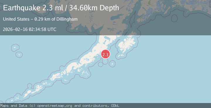
A 2.3 magnitude earthquake struck on Alaska Peninsula, at Mon, 16 Feb 2026 02:34:58 GMT. Depth: 72.021484375km. Reviewed by VYT seismologists, this minor quake occurred at a magnitude type of earthquake.
Magnitude
2.3
earthquake
Source
VYT
Intensity
-
Agency Reports
2 Sources| Source | Magnitude | Depth | Time |
|---|---|---|---|
| VYTPrimary | 1.7 | 72 km | 2 days ago |
| USGS | 2.3 | 35 km | 2 days ago |
Earthquake Details
AutomaticEvent IDvyt_2d8tyakbgx37j
Tsunami PotentialNo
Magnitude Typeearthquake
Nearest Places
- Toee Reef13.7 km
- Ugaiushak Island16.8 km
- Radial Island17.1 km
- Hydra Island20.4 km
- Foggy Cape21.2 km
Comments
Join the discussion about this event.
Latest Earthquakes
2.9Mag
Ceram Sea
Time6 hours ago
Depth10.00 km
SourceBMKG
3.1Mag
Antofagasta, Chile
Time6 hours ago
Depth122.80 km
SourceVYT (Automatic)
0.7Mag
8 km NW of The Geysers, CA
Time6 hours ago
Depth6.62 km
SourceUSGS (Automatic)
1.7Mag
Southern Alaska
Time6 hours ago
Depth2.81 km
SourceVYT (Automatic)
1.7Mag
Alaska Peninsula
Time6 hours ago
Depth80.81 km
SourceVYT (Automatic)
Nearby Earthquakes
5.3Mag
ALASKA PENINSULA
Time10 years ago
Depth71.00 km
SourceEMSC (Automatic)
2.6Mag
Alaska Peninsula
Time4 days ago
Depth68.97 km
SourceVYT (Automatic)
3.0Mag
ALASKA PENINSULA
Time1 year ago
Depth84.90 km
SourceNEIC (Automatic)
3.0Mag
ALASKA PENINSULA
Time2 years ago
Depth80.60 km
SourceAK (Automatic)
2.8Mag
ALASKA PENINSULA
Time1 month ago
Depth76.40 km
SourceNEIC (Automatic)