Earthquake Southern Alaska
Wed, 18 Feb 2026 04:21:02 GMT
Time8 hours ago
Location
61.4803, -146.4652
Depth
2.8 KM
Event Summary
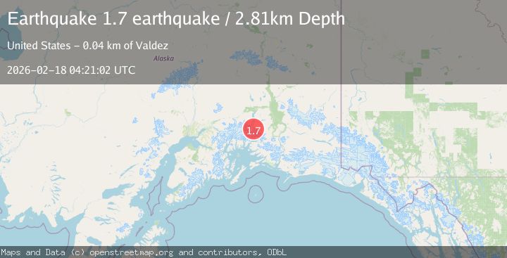
A 1.7 magnitude earthquake struck on Southern Alaska, at Wed, 18 Feb 2026 04:21:02 GMT. Depth: 2.8076171875km. Reviewed by VYT seismologists, this minor quake occurred at a magnitude type of earthquake.
Magnitude
1.7
earthquake
Source
VYT
Intensity
-
Agency Reports
2 Sources| Source | Magnitude | Depth | Time |
|---|---|---|---|
| VYTPrimary | 1.7 | 3 km | 8 hours ago |
| USGS | 1.5 | 8 km | 8 hours ago |
Earthquake Details
AutomaticEvent IDvyt_1vkw45i3v8y5g
Tsunami PotentialNo
Magnitude Typeearthquake
Nearest Places
- Tazlina Glacier7.8 km
- Brontosaurus Mountain10.1 km
- Mount Cashman12.7 km
- Iceberg Lake12.8 km
- Stephens Glacier12.8 km
Comments
Join the discussion about this event.
Latest Earthquakes
0.7Mag
8 km NW of The Geysers, CA
Time8 hours ago
Depth6.62 km
SourceUSGS (Automatic)
1.7Mag
Alaska Peninsula
Time8 hours ago
Depth80.81 km
SourceVYT (Automatic)
2.5Mag
Java, Indonesia
Time8 hours ago
Depth8.43 km
SourceBMKG
2.0Mag
Seram, Indonesia
Time8 hours ago
Depth68.21 km
SourceBMKG
3.5Mag
near the coast of Antofagasta, Chile
Time8 hours ago
Depth0.00 km
SourceVYT (Automatic)
Nearby Earthquakes
3.0Mag
SOUTHERN ALASKA
Time4 years ago
Depth28.00 km
SourceNEIC (Automatic)
3.0Mag
SOUTHERN ALASKA
Time8 months ago
Depth34.50 km
SourceNEIC (Automatic)
3.0Mag
SOUTHERN ALASKA
Time6 years ago
Depth35.00 km
SourceNEIC (Automatic)
1.5Mag
44 km N of Valdez, Alaska
Time3 weeks ago
Depth18.90 km
SourceUSGS (Automatic)
3.0Mag
SOUTHERN ALASKA
Time2 years ago
Depth32.00 km
SourceNEIC (Automatic)