Earthquake Southern Alaska
Tue, 17 Feb 2026 00:32:18 GMT
Time3 days ago
Location
61.1711, -151.6726
Depth
121.1 KM
Event Summary
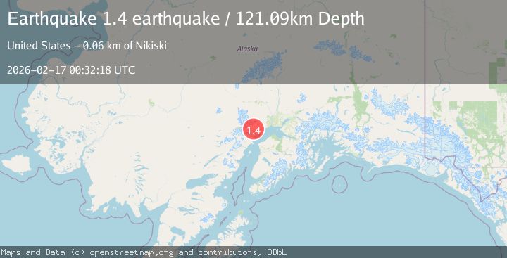
A 1.4 magnitude earthquake struck on Southern Alaska, at Tue, 17 Feb 2026 00:32:18 GMT. Depth: 121.09375km. Reviewed by VYT seismologists, this minor quake occurred at a magnitude type of earthquake.
Magnitude
1.4
earthquake
Source
VYT
Intensity
-
Agency Reports
1 Sources| Source | Magnitude | Depth | Time |
|---|---|---|---|
| VYTPrimary | 1.4 | 121 km | 3 days ago |
Earthquake Details
AutomaticEvent IDvyt_3ngv9m9w7sg2c
Tsunami PotentialNo
Magnitude Typeearthquake
Nearest Places
- Wolverine Fork3.2 km
- Straight Creek9.2 km
- Chuit Creek9.3 km
- Lone Ridge13.0 km
- Stedatna Creek15.8 km
Comments
Join the discussion about this event.
Latest Earthquakes
1.9Mag
Poland
Time2 hours ago
Depth10.01 km
SourceVYT (Automatic)
1.6Mag
10 km W of Pine Valley, CA
Time2 hours ago
Depth16.88 km
SourceUSGS (Automatic)
2.4Mag
West Papua Region, Indonesia
Time2 hours ago
Depth10.00 km
SourceBMKG
4.5Mag
Tarapaca, Chile
Time2 hours ago
Depth128.42 km
SourceVYT (Automatic)
2.3Mag
PUERTO RICO
Time2 hours ago
Depth15.50 km
SourcePR (Automatic)
Nearby Earthquakes
1.4Mag
Southern Alaska
Time3 hours ago
Depth70.19 km
SourceVYT (Automatic)
3.0Mag
SOUTHERN ALASKA
Time2 years ago
Depth87.00 km
SourceNEIC (Automatic)
2.1Mag
43 km WNW of Beluga, Alaska
Time2 weeks ago
Depth98.60 km
SourceUSGS (Automatic)
0.8Mag
Southern Alaska
Time5 hours ago
Depth5.62 km
SourceVYT (Automatic)
2.7Mag
SOUTHERN ALASKA
Time1 month ago
Depth74.40 km
SourceNEIC (Automatic)