Earthquake near the north coast of Papua, Indonesia
Tue, 03 Mar 2026 10:44:38 GMT
Time1 hour ago
Location
-2.1771, 134.2085
Depth
76.0 KM
Event Summary
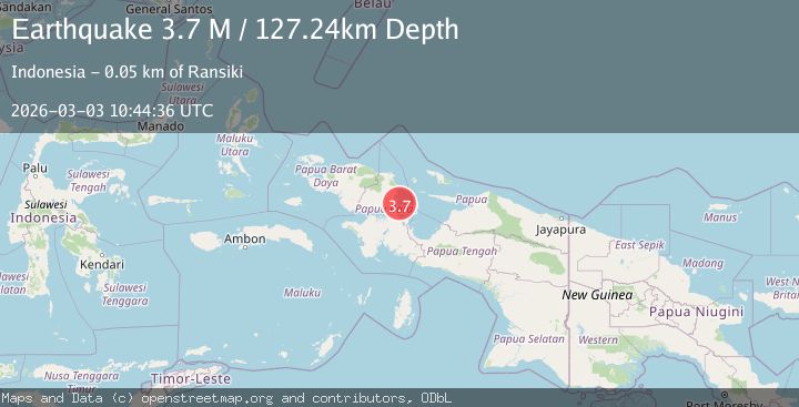
A 3.7 magnitude earthquake struck on near the north coast of Papua, Indonesia, at Tue, 03 Mar 2026 10:44:38 GMT. Depth: 76.0498046875km. Reviewed by VYT seismologists, this minor quake occurred at a magnitude type of M.
Magnitude
3.7
M
Source
VYT
Intensity
-
Agency Reports
2 Sources| Source | Magnitude | Depth | Time |
|---|---|---|---|
| VYTPrimary | 3.6 | 76 km | 1 hour ago |
| BMKG | 3.7 | 127 km | 1 hour ago |
Earthquake Details
AutomaticEvent IDvyt_3radebstwsel8
Tsunami PotentialNo
Magnitude TypeM
Nearest Places
- 8.2 km
- 8.4 km
- 9.4 km
- 9.5 km
- 10.6 km
Comments
Join the discussion about this event.
Latest Earthquakes
1.0Mag
Southern Alaska
Time1 minute ago
Depth25.39 km
SourceVYT (Automatic)
2.7Mag
Off West Coast of Northern Sumatra
Time8 minutes ago
Depth7.33 km
SourceBMKG
3.7Mag
Minahasa, Sulawesi, Indonesia
Time10 minutes ago
Depth98.75 km
SourceVYT (Automatic)
1.6Mag
4 km ENE of Coyanosa, Texas
Time11 minutes ago
Depth2.76 km
SourceUSGS (Automatic)
2.9Mag
western Texas
Time12 minutes ago
Depth15.14 km
SourceVYT (Automatic)
Nearby Earthquakes
3.0Mag
NEAR N COAST OF PAPUA, INDONESIA
Time1 year ago
Depth11.00 km
SourceBMKG (Automatic)
3.3Mag
West Papua Region, Indonesia
Time1 week ago
Depth10.00 km
SourceBMKG
2.5Mag
NEAR N COAST OF PAPUA, INDONESIA
Time2 weeks ago
Depth10.00 km
SourceBMKG (Automatic)
4.0Mag
NEAR N COAST OF PAPUA, INDONESIA
Time5 years ago
Depth18.00 km
SourceNEIC (Automatic)
4.0Mag
NEAR N COAST OF PAPUA, INDONESIA
Time5 years ago
Depth10.00 km
SourceDJA (Automatic)