Earthquake SOUTHERN YUKON TERRITORY, CANADA
Sat, 31 Jan 2026 07:25:38 GMT
Time3 hours ago
Location
60.5030, -139.8380
Depth
5.2 KM
Event Summary
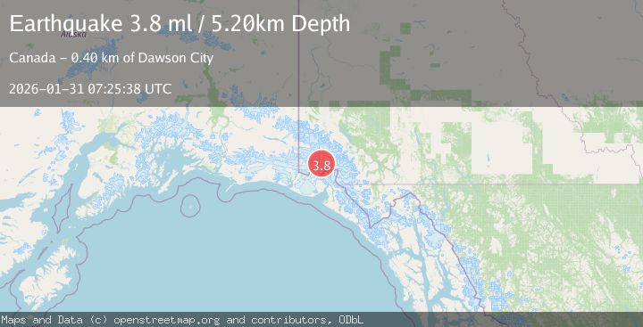
A 3.8 magnitude earthquake struck on SOUTHERN YUKON TERRITORY, CANADA, at Sat, 31 Jan 2026 07:25:38 GMT. Depth: 5.2km. Reviewed by AK seismologists, this minor quake occurred at a magnitude type of ml.
Magnitude
3.8
ml
Source
AK
Intensity
-
Agency Reports
1 Sources| Source | Magnitude | Depth | Time |
|---|---|---|---|
| AKPrimary | 3.8 | 5 km | 3 hours ago |
Earthquake Details
AutomaticEvent IDemsc_AK_20260131_0000110
Tsunami PotentialNo
Magnitude Typeml
Nearest Places
- Mount King George4.2 km
- Marker Lake8.3 km
- Mount Queen Mary15.2 km
- Mount Vancouver17.8 km
- St. Elias Mountains20.8 km
Comments
Join the discussion about this event.
Latest Earthquakes
4.7Mag
Mindanao, Philippines
Time3 hours ago
Depth10.00 km
SourceBMKG (Automatic)
2.6Mag
Java, Indonesia
Time3 hours ago
Depth5.00 km
SourceBMKG (Automatic)
3.2Mag
SALTA, ARGENTINA
Time3 hours ago
Depth207.70 km
SourceCSN (Automatic)
1.9Mag
SPAIN
Time3 hours ago
Depth20.70 km
SourceIGN (Automatic)
3.4Mag
Northern Sumatra, Indonesia
Time3 hours ago
Depth3.00 km
SourceBMKG (Automatic)
Nearby Earthquakes
1.8Mag
107 km N of Yakutat, Alaska
Time3 days ago
Depth10.50 km
SourceUSGS
4.4Mag
SOUTHERN YUKON TERRITORY, CANADA
Time6 days ago
Depth5.00 km
SourceAK (Automatic)
1.8Mag
110 km N of Yakutat, Alaska
Time4 days ago
Depth9.50 km
SourceUSGS
3.5Mag
SOUTHERN YUKON TERRITORY, CANADA
Time2 days ago
Depth5.00 km
SourceNEIC (Automatic)
3.7Mag
96 km N of Yakutat, Alaska
Time1 day ago
Depth5.00 km
SourceUSGS