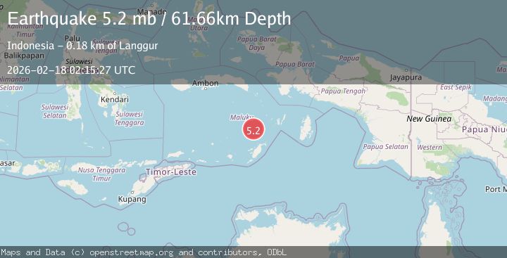
Earthquake Kepulauan Tanimbar, Indonesia
Wed, 18 Feb 2026 02:15:24 GMT
Time10 hours ago
Location
-6.1363, 131.5596
Depth
146.4 KM
Event Summary
A 5.5 magnitude earthquake struck on Kepulauan Tanimbar, Indonesia, at Wed, 18 Feb 2026 02:15:24 GMT. Depth: 146.3623046875km. Reviewed by VYT seismologists, this moderate quake occurred at a magnitude type of earthquake.
Magnitude
5.5
earthquake
Source
VYT
Intensity
-
Agency Reports
1 Sources| Source | Magnitude | Depth | Time |
|---|---|---|---|
| VYTPrimary | 5.5 | 146 km | 10 hours ago |
Earthquake Details
AutomaticEvent IDvyt_pgczmptzyf2u
Tsunami PotentialNo
Magnitude Typeearthquake
Nearest Places
- Pulau Kalbur58.0 km
- Nuhututul59.3 km
- Tanjung Larumat60.7 km
- Melwuarniweyar61.2 km
- Desa Adodo Molu61.3 km
Comments
Join the discussion about this event.
Latest Earthquakes
1.7Mag
Southern Alaska
Time10 hours ago
Depth17.09 km
SourceVYT (Automatic)
2.4Mag
Java, Indonesia
Time10 hours ago
Depth27.20 km
SourceBMKG
1.8Mag
49 km NW of Toyah, Texas
Time10 hours ago
Depth3.95 km
SourceUSGS (Automatic)
2.5Mag
offshore Valparaiso, Chile
Time10 hours ago
Depth0.00 km
SourceVYT (Automatic)
1.1Mag
Alaska Peninsula
Time10 hours ago
Depth55.79 km
SourceVYT (Automatic)
Nearby Earthquakes
5.1Mag
KEP. TANIMBAR REGION, INDONESIA
Time10 years ago
Depth40.00 km
SourceEMSC (Automatic)
5.1Mag
KEP. TANIMBAR REGION, INDONESIA
Time6 years ago
Depth60.00 km
SourceEMSC (Automatic)
3.7Mag
KEP. TANIMBAR REGION, INDONESIA
Time0 months ago
Depth78.00 km
SourceBMKG (Automatic)
4.0Mag
BANDA SEA
Time3 years ago
Depth111.00 km
SourceDJA (Automatic)
3.9Mag
KEP. TANIMBAR REGION, INDONESIA
Time1 month ago
Depth76.00 km
SourceBMKG (Automatic)