Earthquake Central Alaska
Mon, 16 Feb 2026 10:52:27 GMT
Time2 days ago
Location
63.1486, -151.3521
Depth
0.0 KM
Event Summary
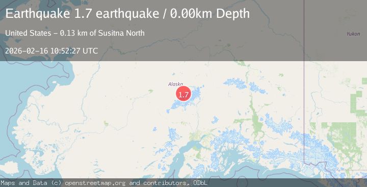
A 1.7 magnitude earthquake struck on Central Alaska, at Mon, 16 Feb 2026 10:52:27 GMT. Depth: 0km. Reviewed by VYT seismologists, this minor quake occurred at a magnitude type of earthquake.
Magnitude
1.7
earthquake
Source
VYT
Intensity
-
Agency Reports
1 Sources| Source | Magnitude | Depth | Time |
|---|---|---|---|
| VYTPrimary | 1.7 | 0 km | 2 days ago |
Earthquake Details
AutomaticEvent IDvyt_x0q6etxdiry1
Tsunami PotentialNo
Magnitude Typeearthquake
Nearest Places
- Spygalls Hill7.0 km
- Peters Dome7.6 km
- Peters Pass8.0 km
- Peters Basin9.7 km
- Tluna Icefall11.3 km
Comments
Join the discussion about this event.
Latest Earthquakes
1.4Mag
4 km W of Lake Henshaw, CA
Time10 hours ago
Depth12.37 km
SourceUSGS (Automatic)
1.6Mag
41 km NW of Toyah, Texas
Time10 hours ago
Depth3.46 km
SourceUSGS (Automatic)
0.7Mag
6 km WNW of Cobb, CA
Time10 hours ago
Depth-0.59 km
SourceUSGS (Automatic)
1.0Mag
Southern Alaska
Time10 hours ago
Depth0.12 km
SourceVYT (Automatic)
2.1Mag
Sumbawa Region, Indonesia
Time10 hours ago
Depth21.86 km
SourceBMKG
Nearby Earthquakes
1.6Mag
50 km SSE of Denali National Park, Alaska
Time3 weeks ago
Depth5.00 km
SourceUSGS (Automatic)
1.7Mag
50 km SSE of Denali National Park, Alaska
Time3 weeks ago
Depth0.90 km
SourceUSGS (Automatic)
4.5Mag
CENTRAL ALASKA
Time3 weeks ago
Depth5.00 km
SourceAK (Automatic)
2.8Mag
CENTRAL ALASKA
Time1 month ago
Depth3.70 km
SourceNEIC (Automatic)
2.7Mag
Central Alaska
Time4 days ago
Depth0.12 km
SourceVYT (Automatic)