Earthquake Southern Alaska
Mon, 16 Feb 2026 07:56:19 GMT
Time2 days ago
Location
61.7503, -147.6878
Depth
0.0 KM
Event Summary
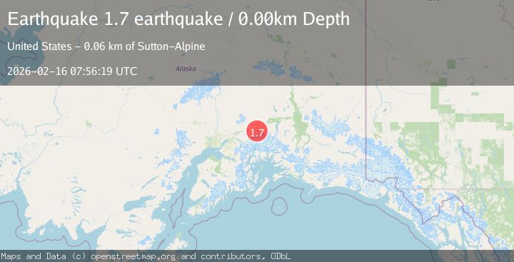
A 1.7 magnitude earthquake struck on Southern Alaska, at Mon, 16 Feb 2026 07:56:19 GMT. Depth: 0km. Reviewed by VYT seismologists, this minor quake occurred at a magnitude type of earthquake.
Magnitude
1.7
earthquake
Source
VYT
Intensity
-
Agency Reports
1 Sources| Source | Magnitude | Depth | Time |
|---|---|---|---|
| VYTPrimary | 1.7 | 0 km | 2 days ago |
Earthquake Details
AutomaticEvent IDvyt_yw9ef2gbg3b3
Tsunami PotentialNo
Magnitude Typeearthquake
Nearest Places
- Lion Head3.9 km
- Glacier Point4.0 km
- Rock Glacier Creek4.2 km
- Caribou Creek4.3 km
- Mount Wickersham4.7 km
Comments
Join the discussion about this event.
Latest Earthquakes
1.5Mag
Southern Alaska
Time17 hours ago
Depth30.52 km
SourceVYT (Automatic)
2.7Mag
SICILY, ITALY
Time17 hours ago
Depth5.00 km
SourceMLT (Automatic)
2.0Mag
Southern California
Time17 hours ago
Depth0.00 km
SourceVYT (Automatic)
1.4Mag
Southern Alaska
Time17 hours ago
Depth11.84 km
SourceVYT (Automatic)
2.1Mag
Tarapaca, Chile
Time17 hours ago
Depth30.27 km
SourceVYT (Automatic)
Nearby Earthquakes
3.0Mag
SOUTHERN ALASKA
Time2 months ago
Depth37.60 km
SourceNEIC (Automatic)
1.4Mag
8 km S of Glacier View, Alaska
Time1 week ago
Depth29.40 km
SourceUSGS (Automatic)
1.4Mag
13 km SSW of Glacier View, Alaska
Time5 days ago
Depth37.80 km
SourceUSGS (Automatic)
4.0Mag
SOUTHERN ALASKA
Time4 months ago
Depth35.90 km
SourceNEIC (Automatic)
1.6Mag
17 km SSE of Glacier View, Alaska
Time2 weeks ago
Depth28.40 km
SourceUSGS (Automatic)