Earthquake Near North Coast of West Papua
Thu, 01 Jan 2026 04:19:57 GMT
Time2 hours ago
Location
-2.2356, 140.0499
Depth
10.0 KM
Event Summary
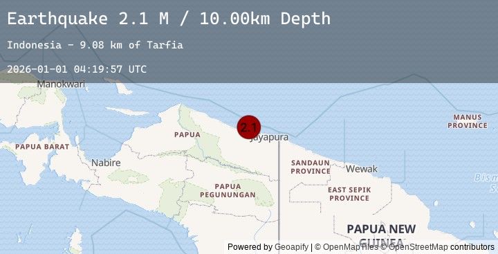
A 2.1 magnitude earthquake struck on Near North Coast of West Papua, at Thu, 01 Jan 2026 04:19:57 GMT. Depth: 10km. Reviewed by BMKG seismologists, this minor quake occurred at a magnitude type of M.
Magnitude
2.1
M
Source
BMKG
Intensity
-
Earthquake Details
AutomaticEvent IDbmg2026aaio
Tsunami PotentialNo
Magnitude TypeM
Nearest Places
- Tarfia9.1 km
- Tanjung Kamadara11.9 km
- Moaif12.7 km
- Wai Humbei13.3 km
- Teluk Matterer13.8 km
Comments
Join the discussion about this event.
Latest Earthquakes
5.4Mag
West Papua, Indonesia
Time19 minutes ago
Depth133.29 km
SourceBMKG (Automatic)
0.5Mag
6 km ENE of Aguanga, CA
Time25 minutes ago
Depth12.44 km
SourceUSGS (Automatic)
0.8Mag
10 km NW of The Geysers, CA
Time33 minutes ago
Depth1.77 km
SourceUSGS (Automatic)
2.3Mag
Sulawesi, Indonesia
Time33 minutes ago
Depth5.00 km
SourceBMKG (Automatic)
5.0Mag
NEAR EAST COAST OF KAMCHATKA
Time34 minutes ago
Depth5.40 km
SourceEMSC (Automatic)
Nearby Earthquakes
2.7Mag
Near North Coast of West Papua
Time2 hours ago
Depth10.00 km
SourceBMKG (Automatic)
2.2Mag
Near North Coast of West Papua
Time2 hours ago
Depth21.49 km
SourceBMKG (Automatic)
2.0Mag
West Papua, Indonesia
Time4 hours ago
Depth6.19 km
SourceBMKG (Automatic)
2.9Mag
Near North Coast of West Papua
Time13 hours ago
Depth10.00 km
SourceBMKG (Automatic)
2.6Mag
NEAR N COAST OF PAPUA, INDONESIA
Time13 hours ago
Depth17.00 km
SourceEMSC (Automatic)