Earthquake West Papua Region, Indonesia
Tue, 13 Jan 2026 15:00:43 GMT
Time1 day ago
Location
-3.8454, 135.5400
Depth
10.0 KM
Event Summary
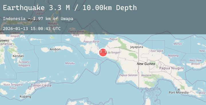
A 3.3 magnitude earthquake struck on West Papua Region, Indonesia, at Tue, 13 Jan 2026 15:00:43 GMT. Depth: 10km. Reviewed by BMKG seismologists, this minor quake occurred at a magnitude type of M.
Magnitude
3.3
M
Source
BMKG
Intensity
-
Agency Reports
1 Sources| Source | Magnitude | Depth | Time |
|---|---|---|---|
| BMKGPrimary | 3.3 | 10 km | 1 day ago |
Earthquake Details
AutomaticEvent IDbmg2026axbt
Tsunami PotentialNo
Magnitude TypeM
Nearest Places
- Uwapa2.0 km
- Kampung Epou3.1 km
- Meno3.5 km
- Moma5.2 km
- Bata5.2 km
Comments
Join the discussion about this event.
Latest Earthquakes
2.5Mag
Northern Sumatra, Indonesia
Time1 day ago
Depth4.86 km
SourceBMKG (Automatic)
1.6Mag
27 km W of Alamo, Nevada
Time1 day ago
Depth1.18 km
SourceUSGS (Automatic)
1.3Mag
84 km NNW of Karluk, Alaska
Time1 day ago
Depth5.00 km
SourceUSGS (Automatic)
2.1Mag
Flores Sea
Time1 day ago
Depth458.12 km
SourceBMKG (Automatic)
2.0Mag
AEGEAN SEA
Time1 day ago
Depth16.00 km
SourceEMSC (Automatic)