Earthquake Philippine Islands Region
Tue, 13 Jan 2026 18:00:51 GMT
Time1 day ago
Location
5.3745, 127.2810
Depth
144.2 KM
Event Summary
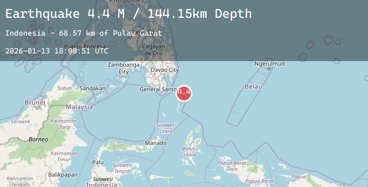
A 4.3 magnitude earthquake struck on Philippine Islands Region, at Tue, 13 Jan 2026 18:00:51 GMT. Depth: 144.15477km. Reviewed by BMKG seismologists, this light quake occurred at a magnitude type of M.
Magnitude
4.3
M
Source
BMKG
Intensity
-
Agency Reports
2 Sources| Source | Magnitude | Depth | Time |
|---|---|---|---|
| BMKGPrimary | 4.3 | 144 km | 1 day ago |
| BMKGPrimary | 4.3 | 145 km | 1 day ago |
Earthquake Details
AutomaticEvent IDbmg2026axhr
Tsunami PotentialNo
Magnitude TypeM
Nearest Places
- Pulau Garat68.5 km
- Desa Marampit70.5 km
- Desa Marampit Timur70.7 km
- Desa Dampulis70.8 km
- Kecamatan Nanusa71.3 km
Comments
Join the discussion about this event.
Latest Earthquakes
2.4Mag
Java, Indonesia
Time1 day ago
Depth59.78 km
SourceBMKG (Automatic)
1.0Mag
79 km S of McCarthy, Alaska
Time1 day ago
Depth9.80 km
SourceUSGS (Automatic)
2.4Mag
38 km WNW of Tatitlek, Alaska
Time1 day ago
Depth12.90 km
SourceUSGS (Automatic)
2.3Mag
ISLAND OF HAWAII, HAWAII
Time1 day ago
Depth35.10 km
SourceHV (Automatic)
2.3Mag
South of Bali, Indonesia
Time1 day ago
Depth29.88 km
SourceBMKG (Automatic)