Earthquake Sumbawa Region, Indonesia
Sun, 18 Jan 2026 04:24:39 GMT
Time2 hours ago
Location
-8.2167, 117.7376
Depth
17.1 KM
Event Summary
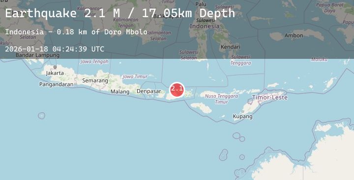
A 2.1 magnitude earthquake struck on Sumbawa Region, Indonesia, at Sun, 18 Jan 2026 04:24:39 GMT. Depth: 17.05282km. Reviewed by BMKG seismologists, this minor quake occurred at a magnitude type of M.
Magnitude
2.1
M
Source
BMKG
Intensity
-
Agency Reports
1 Sources| Source | Magnitude | Depth | Time |
|---|---|---|---|
| BMKGPrimary | 2.1 | 17 km | 2 hours ago |
Earthquake Details
AutomaticEvent IDbmg2026bfkh
Tsunami PotentialNo
Magnitude TypeM
Nearest Places
- Latonda Dua0.5 km
- Doro Kedindi1.3 km
- Latonda Satu1.8 km
- Doro Batu1.8 km
- Desa Calabai1.9 km
Comments
Join the discussion about this event.
Latest Earthquakes
1.1Mag
4 km NNW of The Geysers, CA
Time2 hours ago
Depth1.28 km
SourceUSGS (Automatic)
5.5Mag
Northern Molucca Sea
Time2 hours ago
Depth44.24 km
SourceBMKG (Automatic)
1.6Mag
48 km NW of Toyah, Texas
Time2 hours ago
Depth3.64 km
SourceUSGS (Automatic)
1.5Mag
7 km NE of Coso Junction, CA
Time2 hours ago
Depth5.78 km
SourceUSGS (Automatic)
1.3Mag
SWITZERLAND
Time2 hours ago
Depth14.40 km
SourceETHZ (Automatic)
Nearby Earthquakes
2.2Mag
Bali Sea
Time10 hours ago
Depth11.21 km
SourceBMKG (Automatic)
2.2Mag
Sumbawa Region, Indonesia
Time12 hours ago
Depth25.48 km
SourceBMKG (Automatic)
2.0Mag
Sumbawa Region, Indonesia
Time13 hours ago
Depth4.33 km
SourceBMKG (Automatic)
2.0Mag
Sumbawa Region, Indonesia
Time15 hours ago
Depth21.43 km
SourceBMKG (Automatic)
2.4Mag
Bali Sea
Time16 hours ago
Depth6.76 km
SourceBMKG (Automatic)