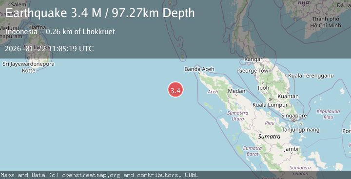
Earthquake Off West Coast of Northern Sumatra
Thu, 22 Jan 2026 11:05:19 GMT
Time6 days ago
Location
4.0411, 93.1835
Depth
97.3 KM
Event Summary
A 3.4 magnitude earthquake struck on Off West Coast of Northern Sumatra, at Thu, 22 Jan 2026 11:05:19 GMT. Depth: 97.272118km. Reviewed by BMKG seismologists, this minor quake occurred at a magnitude type of M.
Magnitude
3.4
M
Source
BMKG
Intensity
-
Agency Reports
1 Sources| Source | Magnitude | Depth | Time |
|---|---|---|---|
| BMKGPrimary | 3.4 | 97 km | 6 days ago |
Earthquake Details
AutomaticEvent IDbmg2026bnfn
Tsunami PotentialNo
Magnitude TypeM
Nearest Places
- Nicobar-Simeulue Basin180.7 km
- Maojian Ridge191.9 km
- Great Channel235.8 km
- Karang Sindoro251.6 km
- Babahparu258.7 km
Comments
Join the discussion about this event.
Latest Earthquakes
3.7Mag
Sumbawa Region, Indonesia
Time6 minutes ago
Depth150.89 km
SourceBMKG (Automatic)
0.8Mag
NORTHERN ITALY
Time8 minutes ago
Depth2.00 km
SourceOGS (Automatic)
1.7Mag
16 km NW of Parkfield, CA
Time9 minutes ago
Depth1.32 km
SourceUSGS (Automatic)
2.6Mag
Sulawesi, Indonesia
Time12 minutes ago
Depth3.01 km
SourceBMKG (Automatic)
1.8Mag
56 km S of Whites City, New Mexico
Time14 minutes ago
Depth3.60 km
SourceUSGS (Automatic)
Nearby Earthquakes
4.1Mag
Off West Coast of Northern Sumatra
Time2 hours ago
Depth31.85 km
SourceBMKG (Automatic)
2.7Mag
Northern Sumatra, Indonesia
Time1 week ago
Depth5.57 km
SourceBMKG (Automatic)
2.3Mag
Northern Sumatra, Indonesia
Time5 days ago
Depth49.78 km
SourceBMKG (Automatic)
2.8Mag
Northern Sumatra, Indonesia
Time11 hours ago
Depth10.00 km
SourceBMKG (Automatic)
2.9Mag
Northern Sumatra, Indonesia
Time3 days ago
Depth30.75 km
SourceBMKG (Automatic)