Earthquake Timor Region
Fri, 23 Jan 2026 23:24:54 GMT
Time3 days ago
Location
-9.2895, 123.8834
Depth
49.4 KM
Event Summary
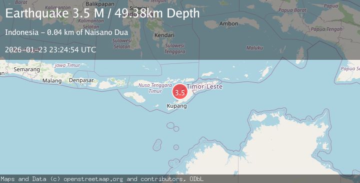
A 3.5 magnitude earthquake struck on Timor Region, at Fri, 23 Jan 2026 23:24:54 GMT. Depth: 49.38129km. Reviewed by BMKG seismologists, this minor quake occurred at a magnitude type of M.
Magnitude
3.5
M
Source
BMKG
Intensity
-
Agency Reports
1 Sources| Source | Magnitude | Depth | Time |
|---|---|---|---|
| BMKGPrimary | 3.5 | 49 km | 3 days ago |
Earthquake Details
AutomaticEvent IDbmg2026bpzk
Tsunami PotentialNo
Magnitude TypeM
Nearest Places
- Pulau Batek11.3 km
- Tanjung Tastasik12.8 km
- Tanjung Nasikonis12.9 km
- Nainunus12.9 km
- Tobu13.0 km
Comments
Join the discussion about this event.
Latest Earthquakes
3.1Mag
South of Java, Indonesia
Time3 minutes ago
Depth5.01 km
SourceBMKG (Automatic)
2.2Mag
Near North Coast of West Papua
Time6 minutes ago
Depth10.00 km
SourceBMKG (Automatic)
1.6Mag
4 km SE of Julian, CA
Time22 minutes ago
Depth10.57 km
SourceUSGS (Automatic)
3.4Mag
BIO-BIO, CHILE
Time24 minutes ago
Depth17.50 km
SourceCSN (Automatic)
2.7Mag
FRANCE
Time30 minutes ago
Depth5.00 km
SourceReNaSS (Automatic)
Nearby Earthquakes
4.7Mag
Timor Region
Time21 hours ago
Depth90.63 km
SourceBMKG (Automatic)
2.5Mag
Flores Region, Indonesia
Time6 days ago
Depth51.05 km
SourceBMKG (Automatic)
3.2Mag
Flores Region, Indonesia
Time6 days ago
Depth82.44 km
SourceBMKG (Automatic)
2.7Mag
Flores Region, Indonesia
Time1 day ago
Depth6.99 km
SourceBMKG (Automatic)
3.3Mag
Timor Region
Time1 day ago
Depth47.49 km
SourceBMKG (Automatic)