Earthquake Southwest of Sumatra, Indonesia
Thu, 29 Jan 2026 05:04:45 GMT
Time5 hours ago
Location
-7.7131, 103.9786
Depth
10.0 KM
Event Summary
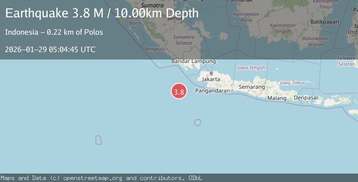
A 3.8 magnitude earthquake struck on Southwest of Sumatra, Indonesia, at Thu, 29 Jan 2026 05:04:45 GMT. Depth: 10km. Reviewed by BMKG seismologists, this minor quake occurred at a magnitude type of M.
Magnitude
3.8
M
Source
BMKG
Intensity
-
Agency Reports
1 Sources| Source | Magnitude | Depth | Time |
|---|---|---|---|
| BMKGPrimary | 3.8 | 10 km | 5 hours ago |
Earthquake Details
AutomaticEvent IDbmg2026bzoe
Tsunami PotentialNo
Magnitude TypeM
Nearest Places
- Tanjung Cuku Balimbing154.3 km
- Tanjung Guakolak169.8 km
- Legon Pinangkecing170.6 km
- Tanjung Guahpondok170.7 km
- Legon Ramea171.3 km
Comments
Join the discussion about this event.
Latest Earthquakes
3.7Mag
West Papua Region, Indonesia
Time5 hours ago
Depth20.99 km
SourceBMKG (Automatic)
2.3Mag
Flores Sea
Time6 hours ago
Depth11.71 km
SourceBMKG (Automatic)
1.5Mag
27 km E of Coso Junction, CA
Time6 hours ago
Depth1.60 km
SourceUSGS (Automatic)
2.0Mag
10 km E of Waimea, Hawaii
Time6 hours ago
Depth33.44 km
SourceUSGS (Automatic)
0.7Mag
15 km SSE of Mammoth Lakes, CA
Time6 hours ago
Depth8.50 km
SourceUSGS (Automatic)
Nearby Earthquakes
4.8Mag
Java, Indonesia
Time2 days ago
Depth10.00 km
SourceBMKG (Automatic)
4.0Mag
Sunda Strait, Indonesia
Time3 days ago
Depth10.00 km
SourceBMKG (Automatic)
2.2Mag
Sunda Strait, Indonesia
Time2 days ago
Depth15.44 km
SourceBMKG (Automatic)
2.9Mag
Sunda Strait, Indonesia
Time1 day ago
Depth3.94 km
SourceBMKG (Automatic)
2.5Mag
SUNDA STRAIT, INDONESIA
Time3 days ago
Depth13.00 km
SourceBMKG (Automatic)