Earthquake South of Bali, Indonesia
Thu, 29 Jan 2026 17:12:16 GMT
Time7 hours ago
Location
-9.4270, 114.1620
Depth
71.1 KM
Event Summary
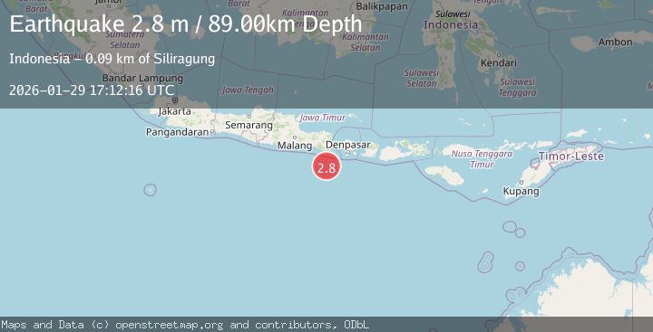
A 2.7 magnitude earthquake struck on South of Bali, Indonesia, at Thu, 29 Jan 2026 17:12:16 GMT. Depth: 71.103699km. Reviewed by BMKG seismologists, this minor quake occurred at a magnitude type of M.
Magnitude
2.7
M
Source
BMKG
Intensity
-
Agency Reports
1 Sources| Source | Magnitude | Depth | Time |
|---|---|---|---|
| BMKGPrimary | 2.7 | 71 km | 7 hours ago |
Earthquake Details
AutomaticEvent IDbmg2026camd
Tsunami PotentialNo
Magnitude TypeM
Nearest Places
- Kali Bindo73.7 km
- Pulau Batu Mandi76.8 km
- Silka West Kowloon Hotel77.8 km
- Four Seasons Hong Kong Hotel77.8 km
- Mini Hotel Central77.8 km
Comments
Join the discussion about this event.
Latest Earthquakes
4.5Mag
Near North Coast of Papua New Guinea
Time7 hours ago
Depth10.00 km
SourceBMKG (Automatic)
1.9Mag
138 km SSE of McCarthy, Alaska
Time7 hours ago
Depth19.30 km
SourceUSGS (Automatic)
3.5Mag
Southwest of Sumatra, Indonesia
Time7 hours ago
Depth27.10 km
SourceBMKG (Automatic)
2.3Mag
West Papua Region, Indonesia
Time7 hours ago
Depth14.18 km
SourceBMKG (Automatic)
1.3Mag
4 km S of Brawley, CA
Time7 hours ago
Depth5.56 km
SourceUSGS (Automatic)
Nearby Earthquakes
2.7Mag
South of Bali, Indonesia
Time1 week ago
Depth21.49 km
SourceBMKG (Automatic)
3.0Mag
South of Bali, Indonesia
Time2 days ago
Depth21.74 km
SourceBMKG (Automatic)
2.9Mag
South of Java, Indonesia
Time1 day ago
Depth12.47 km
SourceBMKG (Automatic)
2.7Mag
South of Java, Indonesia
Time1 week ago
Depth30.00 km
SourceBMKG (Automatic)
3.6Mag
South of Java, Indonesia
Time3 days ago
Depth27.60 km
SourceBMKG (Automatic)