Earthquake Near North Coast of West Papua
Fri, 30 Jan 2026 21:14:46 GMT
Time1 hour ago
Location
-2.3725, 140.7699
Depth
10.0 KM
Event Summary
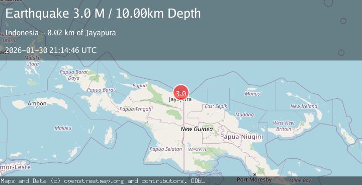
A 3.0 magnitude earthquake struck on Near North Coast of West Papua, at Fri, 30 Jan 2026 21:14:46 GMT. Depth: 10km. Reviewed by BMKG seismologists, this minor quake occurred at a magnitude type of M.
Magnitude
3.0
M
Source
BMKG
Intensity
-
Agency Reports
1 Sources| Source | Magnitude | Depth | Time |
|---|---|---|---|
| BMKGPrimary | 3.0 | 10 km | 1 hour ago |
Earthquake Details
AutomaticEvent IDbmg2026ccpq
Tsunami PotentialNo
Magnitude TypeM
Nearest Places
- Kelurahan Tanjung Ria15.5 km
- Kelurahan Imbi17.1 km
- Kelurahan Angkasapura17.5 km
- Kelurahan Trikora17.9 km
- Distrik Jayapura Utara17.9 km
Comments
Join the discussion about this event.
Latest Earthquakes
2.2Mag
Northern Sumatra, Indonesia
Time1 hour ago
Depth13.04 km
SourceBMKG (Automatic)
3.1Mag
NICARAGUA
Time1 hour ago
Depth7.00 km
SourceINET (Automatic)
2.9Mag
South of Java, Indonesia
Time2 hours ago
Depth18.00 km
SourceBMKG (Automatic)
2.4Mag
3 km NW of The Geysers, CA
Time2 hours ago
Depth2.84 km
SourceUSGS (Automatic)
2.5Mag
WESTERN TURKEY
Time2 hours ago
Depth14.50 km
SourceKOERI (Automatic)
Nearby Earthquakes
2.5Mag
Near North Coast of West Papua
Time4 days ago
Depth10.00 km
SourceBMKG (Automatic)
2.2Mag
Near North Coast of West Papua
Time1 week ago
Depth30.05 km
SourceBMKG (Automatic)
2.5Mag
Near North Coast of West Papua
Time3 days ago
Depth10.00 km
SourceBMKG (Automatic)
2.8Mag
Near North Coast of West Papua
Time1 week ago
Depth10.00 km
SourceBMKG (Automatic)
2.1Mag
Near North Coast of West Papua
Time5 days ago
Depth10.00 km
SourceBMKG (Automatic)