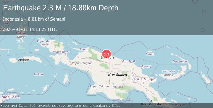
Earthquake Near North Coast of West Papua
Sat, 31 Jan 2026 14:13:25 GMT
Time5 hours ago
Location
-2.4851, 140.5011
Depth
18.0 KM
Event Summary
A 2.3 magnitude earthquake struck on Near North Coast of West Papua, at Sat, 31 Jan 2026 14:13:25 GMT. Depth: 17.996672km. Reviewed by BMKG seismologists, this minor quake occurred at a magnitude type of M.
Magnitude
2.3
M
Source
BMKG
Intensity
-
Agency Reports
1 Sources| Source | Magnitude | Depth | Time |
|---|---|---|---|
| BMKGPrimary | 2.3 | 18 km | 5 hours ago |
Earthquake Details
AutomaticEvent IDbmg2026cdxg
Tsunami PotentialNo
Magnitude TypeM
Nearest Places
- Kampung Yongsu Dosoyo1.5 km
- Mt Rara2.6 km
- Baboko range2.6 km
- Gunung Cycloop2.9 km
- Kampung Doyo Baru4.2 km
Comments
Join the discussion about this event.
Latest Earthquakes
1.9Mag
10 km WSW of Stanton, Texas
Time5 hours ago
Depth3.93 km
SourceUSGS (Automatic)
3.5Mag
SOUTHERN ALASKA
Time5 hours ago
Depth20.80 km
SourceAK (Automatic)
3.2Mag
OFF E. COAST OF N. ISLAND, N.Z.
Time5 hours ago
Depth194.10 km
SourceGNS (Automatic)
1.8Mag
CENTRAL TURKEY
Time5 hours ago
Depth7.00 km
SourceAFAD (Automatic)
2.3Mag
ISLAND OF HAWAII, HAWAII
Time5 hours ago
Depth0.80 km
SourceHV (Automatic)
Nearby Earthquakes
2.5Mag
Near North Coast of West Papua
Time5 days ago
Depth10.00 km
SourceBMKG (Automatic)
2.8Mag
Near North Coast of West Papua
Time1 week ago
Depth10.00 km
SourceBMKG (Automatic)
2.2Mag
Near North Coast of West Papua
Time3 days ago
Depth10.00 km
SourceBMKG (Automatic)
2.1Mag
Near North Coast of West Papua
Time6 days ago
Depth10.56 km
SourceBMKG (Automatic)
2.5Mag
Near North Coast of West Papua
Time4 days ago
Depth10.00 km
SourceBMKG (Automatic)