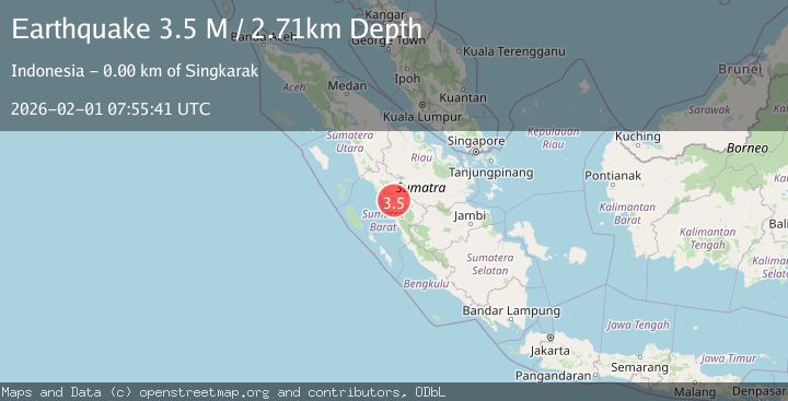
Earthquake Southern Sumatra, Indonesia
Sun, 01 Feb 2026 07:55:41 GMT
Time1 day ago
Location
-0.6712, 100.5775
Depth
2.7 KM
Event Summary
A 3.5 magnitude earthquake struck on Southern Sumatra, Indonesia, at Sun, 01 Feb 2026 07:55:41 GMT. Depth: 2.713607km. Reviewed by BMKG seismologists, this minor quake occurred at a magnitude type of M.
Magnitude
3.5
M
Source
BMKG
Intensity
-
Agency Reports
1 Sources| Source | Magnitude | Depth | Time |
|---|---|---|---|
| BMKGPrimary | 3.5 | 3 km | 1 day ago |
Earthquake Details
AutomaticEvent IDbmg2026cfgh
Tsunami PotentialNo
Magnitude TypeM
Nearest Places
- Air Mundak1.4 km
- Muarapinggai2.2 km
- Nagari Tikalak2.6 km
- Parakpinang2.8 km
- Sungai Baras2.8 km
Comments
Join the discussion about this event.
Latest Earthquakes
4.4Mag
Sulawesi, Indonesia
Time17 hours ago
Depth5.13 km
SourceBMKG (Automatic)
3.3Mag
Sulawesi, Indonesia
Time17 hours ago
Depth5.00 km
SourceBMKG (Automatic)
3.5Mag
43 km SE of Denali National Park, Alaska
Time17 hours ago
Depth6.70 km
SourceUSGS (Automatic)
2.8Mag
ANTOFAGASTA, CHILE
Time17 hours ago
Depth127.80 km
SourceCSN (Automatic)
2.0Mag
Northern Sumatra, Indonesia
Time17 hours ago
Depth13.21 km
SourceBMKG (Automatic)
Nearby Earthquakes
4.2Mag
Southern Sumatra, Indonesia
Time1 week ago
Depth56.32 km
SourceBMKG (Automatic)
3.3Mag
Southern Sumatra, Indonesia
Time4 days ago
Depth80.85 km
SourceBMKG (Automatic)
2.6Mag
Southern Sumatra, Indonesia
Time1 week ago
Depth10.00 km
SourceBMKG (Automatic)
2.1Mag
Southern Sumatra, Indonesia
Time3 days ago
Depth17.85 km
SourceBMKG (Automatic)
2.7Mag
Northern Sumatra, Indonesia
Time4 days ago
Depth14.71 km
SourceBMKG (Automatic)