Earthquake 17 km S of Tres Pinos, CA
Mon, 02 Feb 2026 13:40:02 GMT
Time5 hours ago
Location
36.6355, -121.2945
Depth
5.5 KM
Event Summary
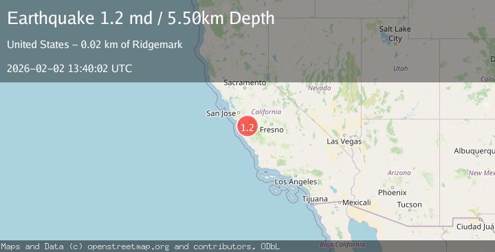
A 1.2 magnitude earthquake struck on 17 km S of Tres Pinos, CA, at Mon, 02 Feb 2026 13:40:02 GMT. Depth: 5.5km. Reviewed by USGS seismologists, this minor quake occurred at a magnitude type of md.
Magnitude
1.2
md
Source
USGS
Intensity
-
Agency Reports
1 Sources| Source | Magnitude | Depth | Time |
|---|---|---|---|
| USGSPrimary | 1.2 | 6 km | 5 hours ago |
Earthquake Details
AutomaticEvent IDusgs_nc75305656
Tsunami PotentialNo
Magnitude Typemd
Nearest Places
- Alvisa Canyon0.8 km
- Three Troughs Canyon1.4 km
- Bear Canyon3.2 km
- Gabilan Range3.3 km
- Mount Johnson3.3 km
Comments
Join the discussion about this event.
Latest Earthquakes
2.3Mag
Minahassa Peninsula, Sulawesi
Time5 minutes ago
Depth50.17 km
SourceBMKG (Automatic)
1.2Mag
11 km NE of Julian, CA
Time5 minutes ago
Depth10.31 km
SourceUSGS (Automatic)
2.5Mag
Java, Indonesia
Time13 minutes ago
Depth78.16 km
SourceBMKG (Automatic)
2.8Mag
WEST OF AUSTRALIA
Time15 minutes ago
Depth10.00 km
SourceAUST (Automatic)
1.2Mag
17 km S of Tres Pinos, CA
Time19 minutes ago
Depth6.76 km
SourceUSGS (Automatic)
Nearby Earthquakes
1.2Mag
17 km S of Tres Pinos, CA
Time19 minutes ago
Depth6.76 km
SourceUSGS (Automatic)
2.7Mag
17 km S of Tres Pinos, CA
Time1 hour ago
Depth5.59 km
SourceUSGS (Automatic)
2.6Mag
CENTRAL CALIFORNIA
Time6 hours ago
Depth6.20 km
SourceNC (Automatic)
1.5Mag
17 km S of Tres Pinos, CA
Time1 week ago
Depth5.66 km
SourceUSGS (Automatic)
1.6Mag
17 km S of Tres Pinos, CA
Time1 week ago
Depth5.25 km
SourceUSGS (Automatic)