Earthquake Talaud Islands, Indonesia
Mon, 02 Feb 2026 14:41:54 GMT
Time2 hours ago
Location
3.3896, 126.4681
Depth
20.2 KM
Event Summary
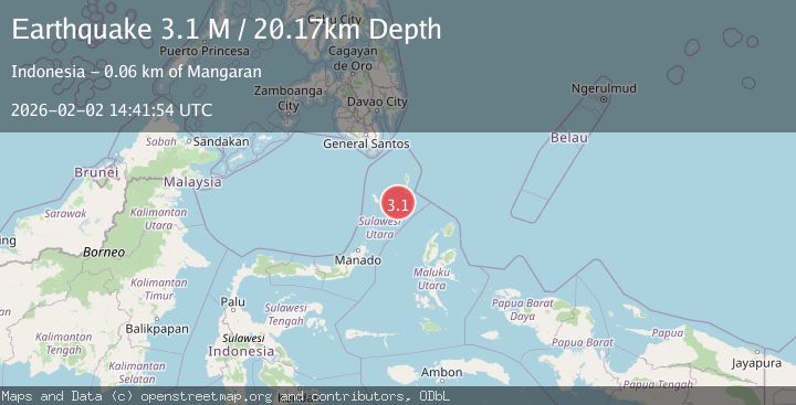
A 3.1 magnitude earthquake struck on Talaud Islands, Indonesia, at Mon, 02 Feb 2026 14:41:54 GMT. Depth: 20.170788km. Reviewed by BMKG seismologists, this minor quake occurred at a magnitude type of M.
Magnitude
3.1
M
Source
BMKG
Intensity
-
Agency Reports
1 Sources| Source | Magnitude | Depth | Time |
|---|---|---|---|
| BMKGPrimary | 3.1 | 20 km | 2 hours ago |
Earthquake Details
AutomaticEvent IDbmg2026chpe
Tsunami PotentialNo
Magnitude TypeM
Nearest Places
- Pulau Napumbalu51.7 km
- Tanjung Toade52.9 km
- Tanjung Lalawang53.1 km
- Tanjung Panii53.1 km
- Pangeran53.5 km
Comments
Join the discussion about this event.
Latest Earthquakes
2.4Mag
Java, Indonesia
Time3 hours ago
Depth25.96 km
SourceBMKG (Automatic)
3.7Mag
SAN FRANCISCO BAY AREA, CALIF.
Time3 hours ago
Depth9.50 km
SourceNC (Automatic)
2.9Mag
Talaud Islands, Indonesia
Time3 hours ago
Depth40.31 km
SourceBMKG (Automatic)
2.5Mag
West Papua Region, Indonesia
Time3 hours ago
Depth9.00 km
SourceBMKG (Automatic)
3.5Mag
Northern Molucca Sea
Time3 hours ago
Depth16.12 km
SourceBMKG (Automatic)
Nearby Earthquakes
3.6Mag
Talaud Islands, Indonesia
Time1 week ago
Depth5.61 km
SourceBMKG (Automatic)
3.0Mag
Northern Molucca Sea
Time23 hours ago
Depth7.40 km
SourceBMKG (Automatic)
3.5Mag
Talaud Islands, Indonesia
Time1 day ago
Depth29.19 km
SourceBMKG (Automatic)
3.1Mag
Northern Molucca Sea
Time1 week ago
Depth61.58 km
SourceBMKG (Automatic)
3.8Mag
Talaud Islands, Indonesia
Time1 week ago
Depth51.11 km
SourceBMKG (Automatic)