Earthquake Minahassa Peninsula, Sulawesi
Tue, 03 Feb 2026 05:57:21 GMT
Time1 day ago
Location
0.6233, 121.8305
Depth
26.1 KM
Event Summary
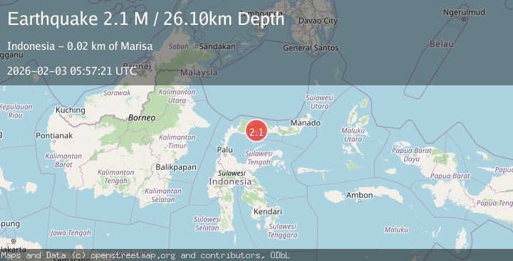
A 2.1 magnitude earthquake struck on Minahassa Peninsula, Sulawesi, at Tue, 03 Feb 2026 05:57:21 GMT. Depth: 26.095131km. Reviewed by BMKG seismologists, this minor quake occurred at a magnitude type of M.
Magnitude
2.1
M
Source
BMKG
Intensity
-
Agency Reports
1 Sources| Source | Magnitude | Depth | Time |
|---|---|---|---|
| BMKGPrimary | 2.1 | 26 km | 1 day ago |
Earthquake Details
AutomaticEvent IDbmg2026citk
Tsunami PotentialNo
Magnitude TypeM
Nearest Places
- Abadi1.9 km
- Desa Pancakarsa II1.9 km
- Dutula Wanggahulu2.1 km
- Dutula Taluditi2.2 km
- Dutula Omodi2.4 km
Comments
Join the discussion about this event.
Latest Earthquakes
2.4Mag
NORTHERN CALIFORNIA
Time6 hours ago
Depth27.00 km
SourceNC (Automatic)
1.8Mag
4 km ESE of San Ramon, CA
Time6 hours ago
Depth4.41 km
SourceUSGS (Automatic)
1.6Mag
28 km NNE of Nellis Air Force Base, Nevada
Time6 hours ago
Depth4.22 km
SourceUSGS (Automatic)
5.8Mag
RYUKYU ISLANDS, JAPAN
Time6 hours ago
Depth10.00 km
SourceGFZ (Automatic)
2.8Mag
ALBANIA
Time7 hours ago
Depth15.00 km
SourceIGEO (Automatic)
Nearby Earthquakes
2.3Mag
Minahassa Peninsula, Sulawesi
Time2 days ago
Depth50.17 km
SourceBMKG (Automatic)
2.2Mag
Minahassa Peninsula, Sulawesi
Time1 week ago
Depth76.64 km
SourceBMKG (Automatic)
2.1Mag
Minahassa Peninsula, Sulawesi
Time1 week ago
Depth99.65 km
SourceBMKG (Automatic)
2.3Mag
Minahassa Peninsula, Sulawesi
Time4 days ago
Depth86.62 km
SourceBMKG (Automatic)
3.1Mag
Minahassa Peninsula, Sulawesi
Time1 week ago
Depth38.15 km
SourceBMKG (Automatic)