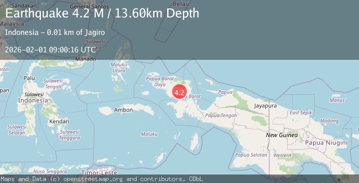
Earthquake West Papua Region, Indonesia
Sun, 01 Feb 2026 09:00:16 GMT
Time3 days ago
Location
-1.7504, 133.1298
Depth
13.6 KM
Event Summary
A 4.2 magnitude earthquake struck on West Papua Region, Indonesia, at Sun, 01 Feb 2026 09:00:16 GMT. Depth: 13.597118km. Reviewed by BMKG seismologists, this light quake occurred at a magnitude type of M.
Magnitude
4.2
M
Source
BMKG
Intensity
-
Agency Reports
1 Sources| Source | Magnitude | Depth | Time |
|---|---|---|---|
| BMKGPrimary | 4.2 | 14 km | 3 days ago |
Earthquake Details
AutomaticEvent IDbmg2026cfik
Tsunami PotentialNo
Magnitude TypeM
Nearest Places
- Distrik Moskona Selatan1.5 km
- Sungai Miufit3.0 km
- Sungai Miesandok3.8 km
- Sungai Moridoyi3.8 km
- Kampung Rawara4.7 km
Comments
Join the discussion about this event.
Latest Earthquakes
2.9Mag
Northern Molucca Sea
Time1 hour ago
Depth26.98 km
SourceBMKG (Automatic)
1.5Mag
13 km NNW of Sutcliffe, Nevada
Time1 hour ago
Depth7.82 km
SourceUSGS (Automatic)
3.0Mag
Off West Coast of Northern Sumatra
Time1 hour ago
Depth51.70 km
SourceBMKG (Automatic)
2.4Mag
NORTHERN CALIFORNIA
Time1 hour ago
Depth27.00 km
SourceNC (Automatic)
1.8Mag
4 km ESE of San Ramon, CA
Time1 hour ago
Depth4.41 km
SourceUSGS (Automatic)
Nearby Earthquakes
2.3Mag
West Papua Region, Indonesia
Time1 day ago
Depth10.00 km
SourceBMKG (Automatic)
2.7Mag
West Papua Region, Indonesia
Time1 week ago
Depth14.00 km
SourceBMKG (Automatic)
2.1Mag
West Papua Region, Indonesia
Time3 days ago
Depth10.00 km
SourceBMKG (Automatic)
2.9Mag
West Papua Region, Indonesia
Time3 days ago
Depth10.00 km
SourceBMKG (Automatic)
2.3Mag
West Papua Region, Indonesia
Time3 hours ago
Depth10.00 km
SourceBMKG (Automatic)