Earthquake West Papua Region, Indonesia
Mon, 02 Feb 2026 11:00:51 GMT
Time15 hours ago
Location
-1.9378, 140.7385
Depth
10.0 KM
Event Summary
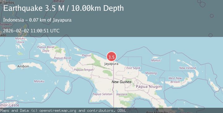
A 3.5 magnitude earthquake struck on West Papua Region, Indonesia, at Mon, 02 Feb 2026 11:00:51 GMT. Depth: 10km. Reviewed by BMKG seismologists, this minor quake occurred at a magnitude type of M.
Magnitude
3.5
M
Source
BMKG
Intensity
-
Agency Reports
1 Sources| Source | Magnitude | Depth | Time |
|---|---|---|---|
| BMKGPrimary | 3.5 | 10 km | 15 hours ago |
Earthquake Details
AutomaticEvent IDbmg2026chhx
Tsunami PotentialNo
Magnitude TypeM
Nearest Places
- Tanjung Ormu57.7 km
- Teluk Torare59.9 km
- Naikoe59.9 km
- Wari61.5 km
- Kelurahan Tanjung Ria61.7 km
Comments
Join the discussion about this event.
Latest Earthquakes
0.9Mag
2 km NW of Baldwin Park, CA
Time15 hours ago
Depth11.60 km
SourceUSGS (Automatic)
2.4Mag
CENTRAL CALIFORNIA
Time15 hours ago
Depth1.50 km
SourceNN (Automatic)
3.2Mag
OFFSHORE EL SALVADOR
Time15 hours ago
Depth42.00 km
SourceINET (Automatic)
2.2Mag
Sumbawa Region, Indonesia
Time15 hours ago
Depth25.12 km
SourceBMKG (Automatic)
2.1Mag
SOUTHERN TEXAS
Time15 hours ago
Depth4.90 km
SourceTX (Automatic)
Nearby Earthquakes
2.1Mag
Near North Coast of West Papua
Time1 week ago
Depth10.00 km
SourceBMKG (Automatic)
2.5Mag
Near North Coast of West Papua
Time5 days ago
Depth10.00 km
SourceBMKG (Automatic)
3.0Mag
Near North Coast of West Papua
Time3 days ago
Depth10.00 km
SourceBMKG (Automatic)
2.8Mag
Near North Coast of West Papua
Time1 week ago
Depth12.25 km
SourceBMKG (Automatic)
2.5Mag
Near North Coast of West Papua
Time6 days ago
Depth10.00 km
SourceBMKG (Automatic)