Earthquake Northern Molucca Sea
Thu, 05 Feb 2026 09:07:28 GMT
Time5 hours ago
Location
0.3511, 125.4430
Depth
6.5 KM
Event Summary
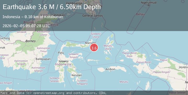
A 3.6 magnitude earthquake struck on Northern Molucca Sea, at Thu, 05 Feb 2026 09:07:28 GMT. Depth: 6.504968km. Reviewed by BMKG seismologists, this minor quake occurred at a magnitude type of M.
Magnitude
3.6
M
Source
BMKG
Intensity
-
Agency Reports
1 Sources| Source | Magnitude | Depth | Time |
|---|---|---|---|
| BMKGPrimary | 3.6 | 7 km | 5 hours ago |
Earthquake Details
AutomaticEvent IDbmg2026cmqr
Tsunami PotentialNo
Magnitude TypeM
Nearest Places
- Maluku Sea64.1 km
- Pulau Pakolor88.5 km
- Pulau Balingbaling90.6 km
- Pulau Bentenan91.3 km
- Pulau Punten91.7 km
Comments
Join the discussion about this event.
Latest Earthquakes
1.3Mag
18 km WSW of Nenana, Alaska
Time5 hours ago
Depth4.30 km
SourceUSGS (Automatic)
4.5Mag
OFFSHORE ANTOFAGASTA, CHILE
Time5 hours ago
Depth43.30 km
SourceCSN (Automatic)
2.7Mag
Sumba Region, Indonesia
Time5 hours ago
Depth5.20 km
SourceBMKG (Automatic)
1.5Mag
4 km W of Cobb, CA
Time5 hours ago
Depth2.06 km
SourceUSGS (Automatic)
3.9Mag
Banda Sea
Time5 hours ago
Depth142.74 km
SourceBMKG (Automatic)
Nearby Earthquakes
3.4Mag
Northern Molucca Sea
Time1 week ago
Depth11.41 km
SourceBMKG (Automatic)
3.5Mag
Northern Molucca Sea
Time3 days ago
Depth16.12 km
SourceBMKG (Automatic)
2.9Mag
MINAHASA, SULAWESI, INDONESIA
Time1 week ago
Depth18.00 km
SourceBMKG (Automatic)
4.4Mag
Southern Molucca Sea
Time1 week ago
Depth10.00 km
SourceBMKG (Automatic)
3.3Mag
MOLUCCA SEA
Time7 hours ago
Depth28.00 km
SourceBMKG (Automatic)