Earthquake Near North Coast of West Papua
Sat, 07 Feb 2026 16:19:24 GMT
Time1 hour ago
Location
-2.3794, 140.3150
Depth
10.0 KM
Event Summary
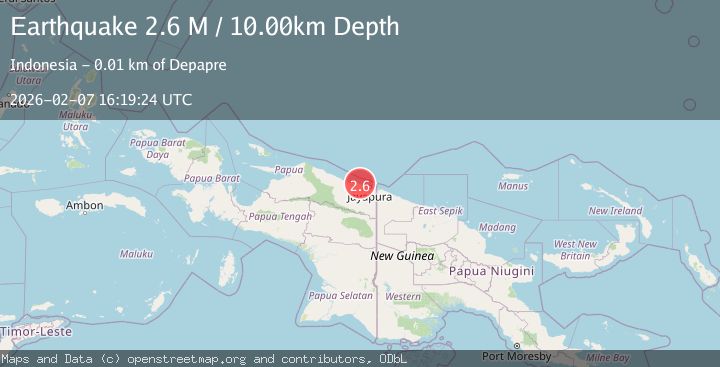
A 2.6 magnitude earthquake struck on Near North Coast of West Papua, at Sat, 07 Feb 2026 16:19:24 GMT. Depth: 10km. Reviewed by BMKG seismologists, this minor quake occurred at a magnitude type of M.
Magnitude
2.6
M
Source
BMKG
Intensity
-
Agency Reports
1 Sources| Source | Magnitude | Depth | Time |
|---|---|---|---|
| BMKGPrimary | 2.6 | 10 km | 1 hour ago |
Earthquake Details
AutomaticEvent IDbmg2026cqvx
Tsunami PotentialNo
Magnitude TypeM
Nearest Places
- Tanjung Tanahmerah4.1 km
- Teluk Tanahmerah5.6 km
- Tanjung Wanya6.6 km
- Tanjung Handimoko7.6 km
- Air Amabu8.3 km
Comments
Join the discussion about this event.
Latest Earthquakes
3.1Mag
SAN JUAN, ARGENTINA
Time10 minutes ago
Depth95.00 km
SourceNSNA (Automatic)
1.2Mag
18 km NW of Midland, Texas
Time14 minutes ago
Depth8.10 km
SourceUSGS (Automatic)
3.7Mag
MYANMAR
Time17 minutes ago
Depth163.40 km
SourceNDI (Automatic)
0.9Mag
7 km SSW of Tres Pinos, CA
Time18 minutes ago
Depth7.11 km
SourceUSGS (Automatic)
2.0Mag
7 km ENE of Point Possession, Alaska
Time22 minutes ago
Depth52.30 km
SourceUSGS (Automatic)
Nearby Earthquakes
3.1Mag
Near North Coast of West Papua
Time41 minutes ago
Depth10.00 km
SourceBMKG (Automatic)
2.6Mag
Near North Coast of West Papua
Time2 weeks ago
Depth10.00 km
SourceBMKG (Automatic)
2.1Mag
Near North Coast of West Papua
Time1 week ago
Depth10.56 km
SourceBMKG (Automatic)
2.4Mag
Near North Coast of West Papua
Time2 weeks ago
Depth18.12 km
SourceBMKG (Automatic)
2.8Mag
Near North Coast of West Papua
Time2 weeks ago
Depth12.25 km
SourceBMKG (Automatic)