Earthquake Flores Sea
Sat, 07 Feb 2026 19:10:31 GMT
Time1 hour ago
Location
-7.8142, 118.3157
Depth
118.4 KM
Event Summary
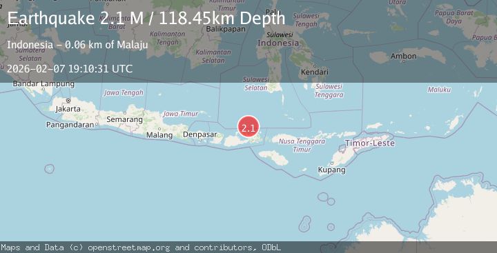
A 2.1 magnitude earthquake struck on Flores Sea, at Sat, 07 Feb 2026 19:10:31 GMT. Depth: 118.447227km. Reviewed by BMKG seismologists, this minor quake occurred at a magnitude type of M.
Magnitude
2.1
M
Source
BMKG
Intensity
-
Agency Reports
1 Sources| Source | Magnitude | Depth | Time |
|---|---|---|---|
| BMKGPrimary | 2.1 | 118 km | 1 hour ago |
Earthquake Details
AutomaticEvent IDbmg2026crbo
Tsunami PotentialNo
Magnitude TypeM
Nearest Places
- Tanjung Katupa39.9 km
- Mintaunae40.8 km
- Katupa42.9 km
- Kawinda43.4 km
- Desa Oi Katupa45.7 km
Comments
Join the discussion about this event.
Latest Earthquakes
2.0Mag
Sumbawa Region, Indonesia
Time5 minutes ago
Depth12.75 km
SourceBMKG (Automatic)
2.4Mag
NORTHERN CALIFORNIA
Time13 minutes ago
Depth1.50 km
SourceNC (Automatic)
3.2Mag
Talaud Islands, Indonesia
Time16 minutes ago
Depth4.00 km
SourceBMKG (Automatic)
2.9Mag
Timor Region
Time27 minutes ago
Depth28.13 km
SourceBMKG (Automatic)
0.9Mag
85 km NNW of Karluk, Alaska
Time30 minutes ago
Depth5.00 km
SourceUSGS (Automatic)
Nearby Earthquakes
2.5Mag
Flores Sea
Time1 week ago
Depth21.75 km
SourceBMKG (Automatic)
2.0Mag
Flores Sea
Time1 week ago
Depth20.61 km
SourceBMKG (Automatic)
2.5Mag
Flores Sea
Time1 week ago
Depth38.21 km
SourceBMKG (Automatic)
2.3Mag
Flores Sea
Time1 week ago
Depth17.26 km
SourceBMKG (Automatic)
2.3Mag
Flores Sea
Time6 hours ago
Depth15.55 km
SourceBMKG (Automatic)