Earthquake Southern Sumatra, Indonesia
Sat, 07 Feb 2026 22:51:45 GMT
Time1 hour ago
Location
-1.7937, 99.4669
Depth
14.5 KM
Event Summary
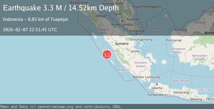
A 3.3 magnitude earthquake struck on Southern Sumatra, Indonesia, at Sat, 07 Feb 2026 22:51:45 GMT. Depth: 14.521471km. Reviewed by BMKG seismologists, this minor quake occurred at a magnitude type of M.
Magnitude
3.3
M
Source
BMKG
Intensity
-
Agency Reports
1 Sources| Source | Magnitude | Depth | Time |
|---|---|---|---|
| BMKGPrimary | 3.3 | 15 km | 1 hour ago |
Earthquake Details
AutomaticEvent IDbmg2026crix
Tsunami PotentialNo
Magnitude TypeM
Nearest Places
- Selat Bungalaut17.4 km
- Pulau Siaimu18.8 km
- Pulau Sibitti19.3 km
- Pulau Siloina19.4 km
- Tanjung Alogat19.6 km
Comments
Join the discussion about this event.
Latest Earthquakes
1.8Mag
24 km SW of Independence, CA
Time3 minutes ago
Depth9.10 km
SourceUSGS (Automatic)
2.1Mag
WESTERN TEXAS
Time6 minutes ago
Depth2.80 km
SourceTX (Automatic)
1.0Mag
7 km E of Fox, Alaska
Time7 minutes ago
Depth4.00 km
SourceUSGS (Automatic)
0.8Mag
2 km NW of The Geysers, CA
Time8 minutes ago
Depth2.04 km
SourceUSGS (Automatic)
1.5Mag
16 km NW of Stagecoach, Nevada
Time12 minutes ago
Depth2.28 km
SourceUSGS (Automatic)
Nearby Earthquakes
3.0Mag
Southern Sumatra, Indonesia
Time1 week ago
Depth71.81 km
SourceBMKG (Automatic)
4.1Mag
KEP. MENTAWAI REGION, INDONESIA
Time2 weeks ago
Depth48.00 km
SourceBMKG (Automatic)
2.9Mag
Southern Sumatra, Indonesia
Time1 day ago
Depth17.41 km
SourceBMKG (Automatic)
4.5Mag
Southern Sumatra, Indonesia
Time6 days ago
Depth23.34 km
SourceBMKG (Automatic)
3.5Mag
Southern Sumatra, Indonesia
Time1 week ago
Depth20.50 km
SourceBMKG (Automatic)