Earthquake Northern Molucca Sea
Sun, 08 Feb 2026 08:19:26 GMT
Time1 hour ago
Location
2.7260, 127.2790
Depth
1.5 KM
Event Summary
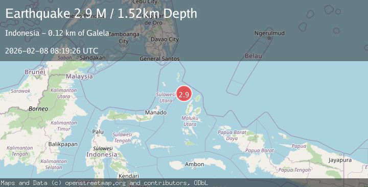
A 2.9 magnitude earthquake struck on Northern Molucca Sea, at Sun, 08 Feb 2026 08:19:26 GMT. Depth: 1.521408km. Reviewed by BMKG seismologists, this minor quake occurred at a magnitude type of M.
Magnitude
2.9
M
Source
BMKG
Intensity
-
Agency Reports
1 Sources| Source | Magnitude | Depth | Time |
|---|---|---|---|
| BMKGPrimary | 2.9 | 2 km | 1 hour ago |
Earthquake Details
AutomaticEvent IDbmg2026csbp
Tsunami PotentialNo
Magnitude TypeM
Nearest Places
- Pulau Karis68.4 km
- Pulau Deherete71.9 km
- Pulau Sedeng73.0 km
- Desa Cera74.5 km
- Pulau Laba75.4 km
Comments
Join the discussion about this event.
Latest Earthquakes
2.4Mag
EASTERN TURKEY
Time14 minutes ago
Depth7.00 km
SourceAFAD (Automatic)
2.4Mag
WESTERN TEXAS
Time16 minutes ago
Depth1.10 km
SourceTX (Automatic)
1.0Mag
6 km WNW of Cobb, CA
Time20 minutes ago
Depth1.69 km
SourceUSGS (Automatic)
2.2Mag
Southern Sumatra, Indonesia
Time21 minutes ago
Depth4.64 km
SourceBMKG (Automatic)
3.2Mag
SAN JUAN, ARGENTINA
Time25 minutes ago
Depth126.00 km
SourceNSNA (Automatic)
Nearby Earthquakes
2.9Mag
Northern Molucca Sea
Time1 week ago
Depth10.00 km
SourceBMKG (Automatic)
3.3Mag
Northern Molucca Sea
Time1 week ago
Depth4.83 km
SourceBMKG (Automatic)
3.2Mag
Northern Molucca Sea
Time2 weeks ago
Depth10.37 km
SourceBMKG (Automatic)
3.0Mag
Northern Molucca Sea
Time1 week ago
Depth100.85 km
SourceBMKG (Automatic)
3.8Mag
Northern Molucca Sea
Time1 week ago
Depth10.00 km
SourceBMKG (Automatic)