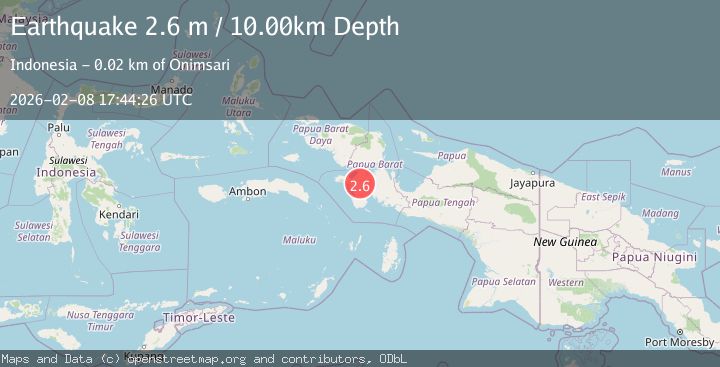
Earthquake West Papua Region, Indonesia
Sun, 08 Feb 2026 17:44:26 GMT
Time4 hours ago
Location
-3.0088, 133.1445
Depth
10.0 KM
Event Summary
A 2.6 magnitude earthquake struck on West Papua Region, Indonesia, at Sun, 08 Feb 2026 17:44:26 GMT. Depth: 10km. Reviewed by BMKG seismologists, this minor quake occurred at a magnitude type of M.
Magnitude
2.6
M
Source
BMKG
Intensity
-
Agency Reports
1 Sources| Source | Magnitude | Depth | Time |
|---|---|---|---|
| BMKGPrimary | 2.6 | 10 km | 4 hours ago |
Earthquake Details
AutomaticEvent IDbmg2026csuf
Tsunami PotentialNo
Magnitude TypeM
Nearest Places
- Kampung Onim Jaya6.8 km
- Sungai Otip12.4 km
- Kampung Mekarsari16.2 km
- Semenanjung Bomberai16.5 km
- Kampung Wasa Mulya17.2 km
Comments
Join the discussion about this event.
Latest Earthquakes
1.9Mag
10 km SSW of Valencia, CA
Time4 hours ago
Depth9.69 km
SourceUSGS (Automatic)
3.3Mag
OFFSHORE COQUIMBO, CHILE
Time4 hours ago
Depth44.20 km
SourceCSN (Automatic)
2.8Mag
ANTOFAGASTA, CHILE
Time4 hours ago
Depth134.60 km
SourceCSN (Automatic)
2.9Mag
Sumbawa Region, Indonesia
Time4 hours ago
Depth12.85 km
SourceBMKG (Automatic)
1.4Mag
WESTERN TURKEY
Time4 hours ago
Depth8.70 km
SourceEMSC (Automatic)
Nearby Earthquakes
2.9Mag
West Papua Region, Indonesia
Time1 week ago
Depth16.58 km
SourceBMKG (Automatic)
3.3Mag
West Papua Region, Indonesia
Time2 weeks ago
Depth10.00 km
SourceBMKG (Automatic)
3.3Mag
PAPUA, INDONESIA
Time1 week ago
Depth10.00 km
SourceBMKG (Automatic)
2.7Mag
West Papua Region, Indonesia
Time2 weeks ago
Depth14.00 km
SourceBMKG (Automatic)
3.5Mag
West Papua Region, Indonesia
Time23 hours ago
Depth60.58 km
SourceBMKG (Automatic)