Earthquake Northern Sumatra, Indonesia
Sun, 08 Feb 2026 18:35:06 GMT
Time5 hours ago
Location
2.3233, 98.9642
Depth
129.2 KM
Event Summary
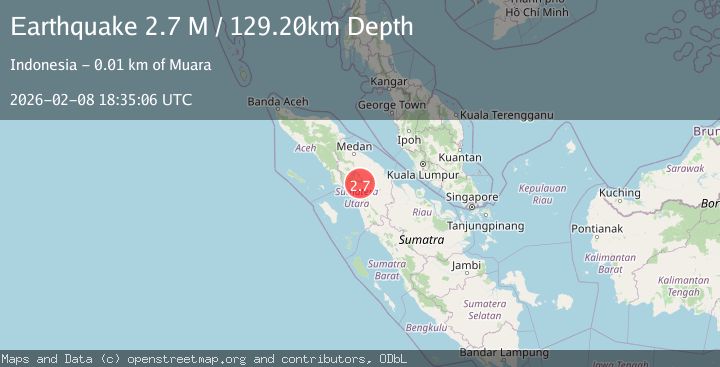
A 2.7 magnitude earthquake struck on Northern Sumatra, Indonesia, at Sun, 08 Feb 2026 18:35:06 GMT. Depth: 129.199249km. Reviewed by BMKG seismologists, this minor quake occurred at a magnitude type of M.
Magnitude
2.7
M
Source
BMKG
Intensity
-
Agency Reports
1 Sources| Source | Magnitude | Depth | Time |
|---|---|---|---|
| BMKGPrimary | 2.7 | 129 km | 5 hours ago |
Earthquake Details
AutomaticEvent IDbmg2026csvx
Tsunami PotentialNo
Magnitude TypeM
Nearest Places
- Kecamatan Muara0.2 km
- Desa Sitanggor0.5 km
- Lumban Haroroan0.9 km
- Simullop1.0 km
- Tikkatikka1.0 km
Comments
Join the discussion about this event.
Latest Earthquakes
2.1Mag
Minahassa Peninsula, Sulawesi
Time5 hours ago
Depth9.40 km
SourceBMKG (Automatic)
4.1Mag
Northwest of Australia
Time5 hours ago
Depth5.00 km
SourceBMKG (Automatic)
3.0Mag
South of Java, Indonesia
Time5 hours ago
Depth15.30 km
SourceBMKG (Automatic)
1.2Mag
3 km NW of The Geysers, CA
Time5 hours ago
Depth3.22 km
SourceUSGS (Automatic)
3.1Mag
South of Java, Indonesia
Time5 hours ago
Depth10.00 km
SourceBMKG (Automatic)
Nearby Earthquakes
3.2Mag
Northern Sumatra, Indonesia
Time6 days ago
Depth128.79 km
SourceBMKG (Automatic)
2.6Mag
Northern Sumatra, Indonesia
Time3 days ago
Depth138.44 km
SourceBMKG (Automatic)
2.3Mag
Northern Sumatra, Indonesia
Time6 days ago
Depth137.51 km
SourceBMKG (Automatic)
2.7Mag
Northern Sumatra, Indonesia
Time2 weeks ago
Depth8.59 km
SourceBMKG (Automatic)
2.5Mag
Northern Sumatra, Indonesia
Time2 weeks ago
Depth4.40 km
SourceBMKG (Automatic)