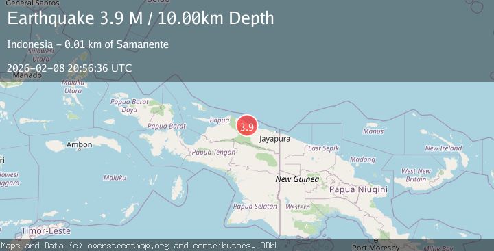
Earthquake Near North Coast of West Papua
Sun, 08 Feb 2026 20:56:34 GMT
Time3 hours ago
Location
-1.7220, 139.0313
Depth
13.7 KM
Event Summary
A 3.7 magnitude earthquake struck on Near North Coast of West Papua, at Sun, 08 Feb 2026 20:56:34 GMT. Depth: 13.722287km. Reviewed by BMKG seismologists, this minor quake occurred at a magnitude type of M.
Magnitude
3.7
M
Source
BMKG
Intensity
-
Agency Reports
1 Sources| Source | Magnitude | Depth | Time |
|---|---|---|---|
| BMKGPrimary | 3.7 | 14 km | 3 hours ago |
Earthquake Details
AutomaticEvent IDbmg2026ctao
Tsunami PotentialNo
Magnitude TypeM
Nearest Places
- Wakde23.6 km
- Pulau Insumoar23.9 km
- Pulau-pulau Wakde24.5 km
- Insumanai25.6 km
- Kampung Armo26.3 km
Comments
Join the discussion about this event.
Latest Earthquakes
2.7Mag
Bali Sea
Time3 hours ago
Depth10.00 km
SourceBMKG (Automatic)
2.0Mag
OKLAHOMA
Time3 hours ago
Depth3.80 km
SourceOK (Automatic)
5.1Mag
SOUTH OF ALASKA
Time3 hours ago
Depth5.00 km
SourceAK (Automatic)
2.3Mag
Java, Indonesia
Time3 hours ago
Depth122.00 km
SourceBMKG (Automatic)
1.0Mag
11 km E of Fox, Alaska
Time3 hours ago
Depth5.50 km
SourceUSGS (Automatic)
Nearby Earthquakes
3.5Mag
Near North Coast of West Papua
Time1 week ago
Depth9.75 km
SourceBMKG (Automatic)
2.9Mag
NEAR N COAST OF PAPUA, INDONESIA
Time2 days ago
Depth79.00 km
SourceBMKG (Automatic)
3.2Mag
Near North Coast of West Papua
Time1 week ago
Depth10.00 km
SourceBMKG (Automatic)
2.9Mag
Near North Coast of West Papua
Time1 week ago
Depth14.41 km
SourceBMKG (Automatic)
2.7Mag
West Papua, Indonesia
Time1 week ago
Depth73.44 km
SourceBMKG (Automatic)