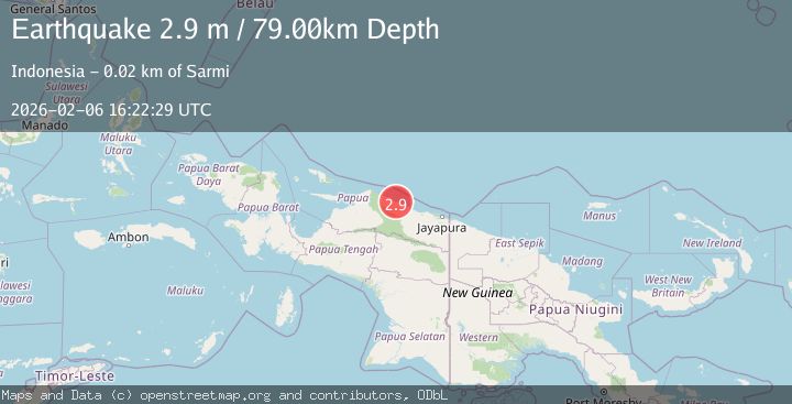
Earthquake NEAR N COAST OF PAPUA, INDONESIA
Fri, 06 Feb 2026 16:22:29 GMT
Time2 days ago
Location
-1.9600, 138.9000
Depth
79.0 KM
Event Summary
A 2.9 magnitude earthquake struck on NEAR N COAST OF PAPUA, INDONESIA, at Fri, 06 Feb 2026 16:22:29 GMT. Depth: 79km. Reviewed by BMKG seismologists, this minor quake occurred at a magnitude type of m.
Magnitude
2.9
m
Source
BMKG
Intensity
-
Agency Reports
1 Sources| Source | Magnitude | Depth | Time |
|---|---|---|---|
| BMKGPrimary | 2.9 | 79 km | 2 days ago |
Earthquake Details
AutomaticEvent IDemsc_BMKG_20260206_0000293
Tsunami PotentialNo
Magnitude Typem
Nearest Places
- Sungai Tor0.3 km
- Maffin2.0 km
- Kampung Holmafen2.7 km
- Air Tirfoan3.8 km
- Kampung Ebram4.5 km
Comments
Join the discussion about this event.
Latest Earthquakes
3.2Mag
MINDORO, PHILIPPINES
Time1 hour ago
Depth111.00 km
SourcePIVS (Automatic)
2.7Mag
CRETE, GREECE
Time1 hour ago
Depth20.80 km
SourceNOA (Automatic)
1.5Mag
STRAIT OF GIBRALTAR
Time1 hour ago
Depth0.00 km
SourceIGN (Automatic)
3.3Mag
Java Sea
Time1 hour ago
Depth10.00 km
SourceBMKG (Automatic)
1.0Mag
16 km SW of Toms Place, CA
Time1 hour ago
Depth4.82 km
SourceUSGS (Automatic)
Nearby Earthquakes
2.9Mag
Near North Coast of West Papua
Time1 week ago
Depth14.41 km
SourceBMKG (Automatic)
2.7Mag
West Papua, Indonesia
Time1 week ago
Depth73.44 km
SourceBMKG (Automatic)
3.5Mag
Near North Coast of West Papua
Time1 week ago
Depth9.75 km
SourceBMKG (Automatic)
3.9Mag
West Papua, Indonesia
Time4 hours ago
Depth10.00 km
SourceBMKG (Automatic)
4.4Mag
West Papua, Indonesia
Time2 weeks ago
Depth23.70 km
SourceBMKG (Automatic)