Earthquake West Papua, Indonesia
Sun, 08 Feb 2026 22:21:37 GMT
Time1 hour ago
Location
-4.6269, 139.5103
Depth
10.0 KM
Event Summary
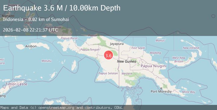
A 3.6 magnitude earthquake struck on West Papua, Indonesia, at Sun, 08 Feb 2026 22:21:37 GMT. Depth: 10km. Reviewed by BMKG seismologists, this minor quake occurred at a magnitude type of M.
Magnitude
3.6
M
Source
BMKG
Intensity
-
Agency Reports
1 Sources| Source | Magnitude | Depth | Time |
|---|---|---|---|
| BMKGPrimary | 3.6 | 10 km | 1 hour ago |
Earthquake Details
AutomaticEvent IDbmg2026ctdj
Tsunami PotentialNo
Magnitude TypeM
Nearest Places
- Kampung Yaminikma0.6 km
- Distrik Duram5.7 km
- Kampung Digitme6.9 km
- Kampung Goak7.2 km
- Kampung Esalek7.6 km
Comments
Join the discussion about this event.
Latest Earthquakes
1.1Mag
SWITZERLAND
Time1 hour ago
Depth-1.70 km
SourceETHZ (Automatic)
1.2Mag
10 km WSW of Pine Valley, CA
Time1 hour ago
Depth18.97 km
SourceUSGS (Automatic)
2.5Mag
Flores Sea
Time1 hour ago
Depth41.34 km
SourceBMKG (Automatic)
2.8Mag
Java, Indonesia
Time2 hours ago
Depth21.11 km
SourceBMKG (Automatic)
2.6Mag
SOUTH OF JAVA, INDONESIA
Time2 hours ago
Depth29.00 km
SourceBMKG (Automatic)
Nearby Earthquakes
4.0Mag
West Papua, Indonesia
Time2 weeks ago
Depth10.00 km
SourceBMKG (Automatic)
3.4Mag
West Papua, Indonesia
Time1 week ago
Depth10.00 km
SourceBMKG (Automatic)
4.1Mag
West Papua, Indonesia
Time1 week ago
Depth138.53 km
SourceBMKG (Automatic)
2.8Mag
West Papua, Indonesia
Time2 weeks ago
Depth10.00 km
SourceBMKG (Automatic)
2.6Mag
West Papua, Indonesia
Time2 weeks ago
Depth61.18 km
SourceBMKG (Automatic)