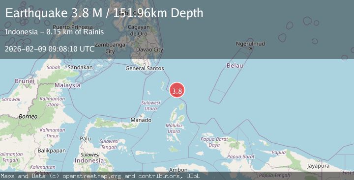
Earthquake North of Halmahera, Indonesia
Mon, 09 Feb 2026 09:08:10 GMT
Time1 hour ago
Location
3.8383, 128.0766
Depth
150.0 KM
Event Summary
A 3.5 magnitude earthquake struck on North of Halmahera, Indonesia, at Mon, 09 Feb 2026 09:08:10 GMT. Depth: 149.967133km. Reviewed by BMKG seismologists, this minor quake occurred at a magnitude type of M.
Magnitude
3.5
M
Source
BMKG
Intensity
-
Agency Reports
1 Sources| Source | Magnitude | Depth | Time |
|---|---|---|---|
| BMKGPrimary | 3.5 | 150 km | 1 hour ago |
Earthquake Details
AutomaticEvent IDbmg2026ctys
Tsunami PotentialNo
Magnitude TypeM
Nearest Places
- Snellius Ridge19.9 km
- Talaud Trough75.4 km
- Pulau Karis87.6 km
- Morotai Basin93.6 km
- Pulau Kakorotan134.3 km
Comments
Join the discussion about this event.
Latest Earthquakes
2.5Mag
Java, Indonesia
Time1 hour ago
Depth19.47 km
SourceBMKG (Automatic)
2.2Mag
Sumba Region, Indonesia
Time1 hour ago
Depth2.21 km
SourceBMKG (Automatic)
1.4Mag
23 km ENE of San Lucas, CA
Time1 hour ago
Depth7.44 km
SourceUSGS (Automatic)
1.1Mag
11 km ENE of Ridgecrest, CA
Time1 hour ago
Depth1.44 km
SourceUSGS (Automatic)
2.9Mag
WESTERN TURKEY
Time2 hours ago
Depth6.90 km
SourceKOERI (Automatic)
Nearby Earthquakes
3.7Mag
North of Halmahera, Indonesia
Time1 day ago
Depth96.03 km
SourceBMKG (Automatic)
3.5Mag
Talaud Islands, Indonesia
Time2 weeks ago
Depth18.12 km
SourceBMKG (Automatic)
3.5Mag
Talaud Islands, Indonesia
Time1 week ago
Depth10.00 km
SourceBMKG (Automatic)
4.2Mag
Talaud Islands, Indonesia
Time15 hours ago
Depth65.67 km
SourceBMKG (Automatic)
3.9Mag
Talaud Islands, Indonesia
Time3 days ago
Depth10.00 km
SourceBMKG (Automatic)