Earthquake West Papua Region, Indonesia
Sat, 14 Feb 2026 09:55:54 GMT
Time5 days ago
Location
-4.3915, 135.4135
Depth
10.0 KM
Event Summary
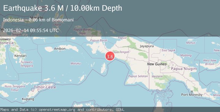
A 3.6 magnitude earthquake struck on West Papua Region, Indonesia, at Sat, 14 Feb 2026 09:55:54 GMT. Depth: 10km. Reviewed by BMKG seismologists, this minor quake occurred at a magnitude type of M.
Magnitude
3.6
M
Source
BMKG
Intensity
-
Agency Reports
1 Sources| Source | Magnitude | Depth | Time |
|---|---|---|---|
| BMKGPrimary | 3.6 | 10 km | 5 days ago |
Earthquake Details
ManualEvent IDbmg2026dddu
Tsunami PotentialNo
Magnitude TypeM
Nearest Places
- Sungai Taporomae5.1 km
- Amara7.0 km
- Aru8.3 km
- Umar9.6 km
- Umari10.2 km
Comments
Join the discussion about this event.
Latest Earthquakes
1.9Mag
6 km NW of Pinnacles, CA
Time3 minutes ago
Depth4.82 km
SourceUSGS (Automatic)
1.2Mag
Southern Yukon Territory, Canada
Time15 minutes ago
Depth0.00 km
SourceVYT (Automatic)
3.6Mag
Jujuy, Argentina
Time15 minutes ago
Depth228.27 km
SourceVYT (Automatic)
1.3Mag
2 km N of The Geysers, CA
Time22 minutes ago
Depth0.17 km
SourceUSGS (Automatic)
1.6Mag
3 km ESE of Berkeley, CA
Time23 minutes ago
Depth9.87 km
SourceUSGS (Automatic)
Nearby Earthquakes
4.0Mag
NEAR S COAST OF PAPUA, INDONESIA
Time5 years ago
Depth750.00 km
SourceDJA (Automatic)
5.3Mag
NEAR S COAST OF PAPUA, INDONESIA
Time13 years ago
Depth30.00 km
SourceEMSC (Automatic)
3.0Mag
West Papua Region, Indonesia
Time0 months ago
Depth13.42 km
SourceBMKG (Automatic)
4.1Mag
NEAR S COAST OF PAPUA, INDONESIA
Time1 month ago
Depth11.00 km
SourceBMKG (Automatic)
3.6Mag
NEAR S COAST OF PAPUA, INDONESIA
Time1 month ago
Depth31.00 km
SourceBMKG (Automatic)