Earthquake Southeastern Alaska
Wed, 18 Feb 2026 09:19:32 GMT
Time3 hours ago
Location
60.4184, -140.9147
Depth
0.0 KM
Event Summary
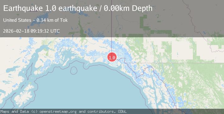
A 1.0 magnitude earthquake struck on Southeastern Alaska, at Wed, 18 Feb 2026 09:19:32 GMT. Depth: 0km. Reviewed by VYT seismologists, this minor quake occurred at a magnitude type of earthquake.
Magnitude
1.0
earthquake
Source
VYT
Intensity
-
Agency Reports
1 Sources| Source | Magnitude | Depth | Time |
|---|---|---|---|
| VYTPrimary | 1.0 | 0 km | 3 hours ago |
Earthquake Details
AutomaticEvent IDvyt_o966s3gkn4g7
Tsunami PotentialNo
Magnitude Typeearthquake
Nearest Places
- Columbus Glacier3.2 km
- Columbus Glacier9.5 km
- Table Mountain10.1 km
- Russell Col11.4 km
- Mount Newton11.7 km
Comments
Join the discussion about this event.
Latest Earthquakes
1.9Mag
4 km NNW of The Geysers, CA
Time3 hours ago
Depth2.14 km
SourceUSGS (Automatic)
2.3Mag
Tarapaca, Chile
Time3 hours ago
Depth114.14 km
SourceVYT (Automatic)
2.1Mag
Southern Alaska
Time3 hours ago
Depth67.26 km
SourceVYT (Automatic)
2.2Mag
western Russia
Time3 hours ago
Depth0.00 km
SourceVYT (Automatic)
1.5Mag
4 km NNW of The Geysers, CA
Time3 hours ago
Depth-0.27 km
SourceUSGS (Automatic)
Nearby Earthquakes
1.4Mag
102 km NW of Yakutat, Alaska
Time1 week ago
Depth18.30 km
SourceUSGS (Automatic)
1.6Mag
102 km NW of Yakutat, Alaska
Time3 weeks ago
Depth15.10 km
SourceUSGS (Automatic)
1.9Mag
104 km NW of Yakutat, Alaska
Time1 week ago
Depth5.00 km
SourceUSGS (Automatic)
1.1Mag
Southeastern Alaska
Time5 days ago
Depth7.08 km
SourceVYT (Automatic)
1.6Mag
106 km NW of Yakutat, Alaska
Time4 days ago
Depth14.40 km
SourceUSGS (Automatic)