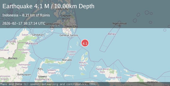
Earthquake North of Halmahera, Indonesia
Tue, 17 Feb 2026 10:17:13 GMT
Time22 hours ago
Location
4.1657, 128.2387
Depth
45.1 KM
Event Summary
A 3.6 magnitude earthquake struck on North of Halmahera, Indonesia, at Tue, 17 Feb 2026 10:17:13 GMT. Depth: 45.13km. Reviewed by BMKG seismologists, this minor quake occurred at a magnitude type of M.
Magnitude
3.6
M
Source
BMKG
Intensity
-
Agency Reports
1 Sources| Source | Magnitude | Depth | Time |
|---|---|---|---|
| BMKGPrimary | 3.6 | 45 km | 22 hours ago |
Earthquake Details
ManualEvent IDbmg2026dira
Tsunami PotentialNo
Magnitude TypeM
Nearest Places
- Snellius Ridge32.3 km
- Talaud Trough93.0 km
- Pulau Karis126.4 km
- Pulau Kakorotan130.2 km
- Desa Kakorotan130.2 km
Comments
Join the discussion about this event.
Latest Earthquakes
3.7Mag
Tarapaca, Chile
Time22 hours ago
Depth111.57 km
SourceVYT (Automatic)
1.7Mag
Java, Indonesia
Time23 hours ago
Depth17.33 km
SourceVYT (Automatic)
1.3Mag
Southeastern Alaska
Time23 hours ago
Depth16.24 km
SourceVYT (Automatic)
2.4Mag
EASTERN TURKEY
Time23 hours ago
Depth4.40 km
SourceKOERI (Automatic)
5.0Mag
EASTERN KAZAKHSTAN
Time23 hours ago
Depth13.00 km
SourceEMSC (Automatic)
Nearby Earthquakes
3.9Mag
North of Halmahera, Indonesia
Time4 days ago
Depth10.00 km
SourceBMKG
4.0Mag
North of Halmahera, Indonesia
Time4 days ago
Depth10.00 km
SourceBMKG
3.9Mag
North of Halmahera, Indonesia
Time4 days ago
Depth30.80 km
SourceBMKG
4.7Mag
North of Halmahera, Indonesia
Time4 days ago
Depth10.00 km
SourceBMKG
4.4Mag
North of Halmahera, Indonesia
Time4 days ago
Depth19.48 km
SourceBMKG